Day 3
Kyushu II Island
Nagasaki, the shadow of the atomic bomb looms large.
Politics and society
The rain falls heavily during the night. I wake up at 5 am, when it is already light even with cloudy skies. The onsen at the bottom of the valley where Yufuin is located are emitting a white smoke, and I have a cup of tea with some cookies in silence at the local community center. About half an hour later, we are driving on the two-lane highway (as all others are) that leads to Kumamoto. We notice how there are designated areas along the road for installing chains, which is clear evidence that the winter must be harsh, even though this is the southernmost island at only 33 degrees north latitude. The landscape is green, with a few meadows and dense forests of cypress trees, bamboo, and all other types of tall vegetation. It was 11°C. The sky is already clear despite the clouds, but it gradually clears, leaving space for steam that seems to be emanating from the ground, like smoke from the onsen; finally, it completely opens up, reaching 22/23°C in the afternoon when a cool breeze blows. The itinerary does not allow for stops, and we head directly to Nagasaki, which is located in a bay on the East China Sea (which they will of course call differently here), at the end of a long peninsula. The city is unfortunately famous for being the site of… second atomic bomb, is actually much more than a living memorial to what happened 80 years ago. It's a place where the quality of life must be very high, and the contrast between the sea and the hills offers truly beautiful views. We will start, of course, from the point in time when everything stopped on that day, June 9, 1945, when an American plane at 11:02, I detached the Fat Boy.... the plutonium bomb that instantly killed over 75,000 people (plus many more who died later), and injured an impossible number to calculate exactly, on a population of 240,000; the victims were not significantly higher due to the hills which prevented the spread of the combined action between explosion (50% of the energy released by the blast), hot winds over 200 km/h (35%) and radioactive fallout (15%). The city was chosen among a series of other "candidates" (including Tokyo and Kyoto) due to the presence of heavy industries that produced military materials, particularly those of Mitsubishi; because it was cloudy, the explosion – which occurred 500 meters above the city – instead of hitting the industrial zone where the factories were located, ended up having its hypocenter in the northern residential area, killing mainly women and children since men were at war or elsewhere at work; many Korean prisoners who were working on forced labor were also killed, as well as several hundred allied detainees; details that did not change the decision.
Arrival at Megami Bridge
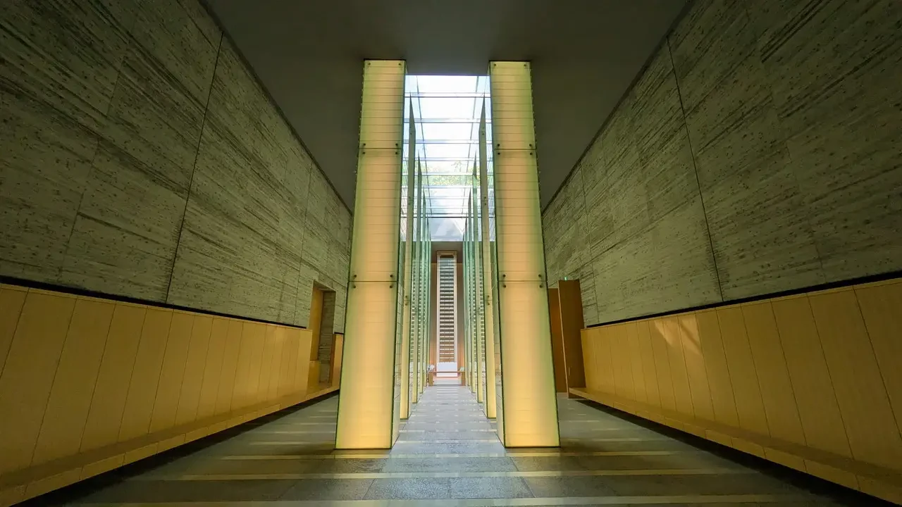
At 8:30 we are at the Park of Peace, taking a walk around the Fountain of Peace in the shape of a dove, in memory of those who, having been drained by the heat of the bomb, asked for water and quenched their thirst with the radioactive rain created by the bomb itself: obviously, they did not survive long. Inside, the center consists of a memorial area, where you can find the columns of light... at the bottom of which another contains a stack of books kept at a controlled temperature, where the names of all the victims are listed for permanent remembrance. Adjacent to the museum is a collected the findings... the testimonies and drawings/graphics to explain what happened from a technical point of view and clarify reasons and background. Let's watch the video where a woman miraculously survived the disaster but was irreparably injured, both physically and emotionally. At the time, she was a child. After receiving loving care from her mother, she managed to come to terms with the remaining injuries on her body and became a symbol of the testimony of what happened; she began by participating in a conference in Geneva and continued traveling around the world as a direct witness to what happened, despite the limitation of having to live in a wheelchair. Her tone of voice and words do not reveal any resentment or feelings of hatred; instead, they clearly show her desire to share her experiences so that they become a warning to raise awareness about the need to ban atomic bombs. The footage was filmed at the beginning of the 1990s and shows her as a woman in her fifties.
When we step outside, the sun shines on our heads, and we wonder why it does so for so much unworthy humanity.
The urban face of Megami Bridge
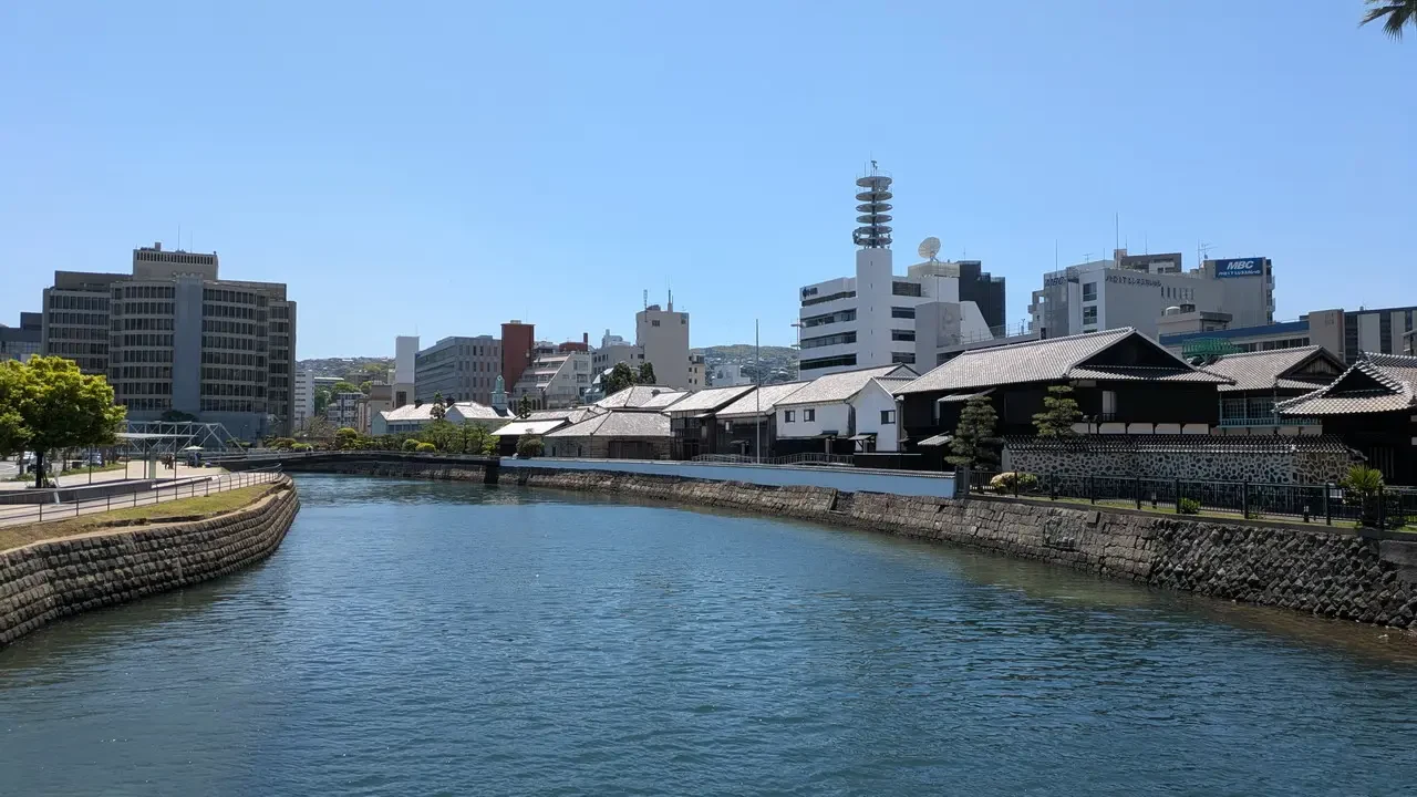
To change the subject, let's explore the city center, which is located on the shores of the calm bay with the [landmark] in the background. Megami Bridge... a plastic bridge to join the two land edges separated by the same. After a walk through flower-lined streets, we approach the old district where the houses and warehouses of the Dutch merchants are located, the only foreigners allowed until 1850; at that time, foreigners could not enter Japan and trade was carried out exclusively via the artificial island of Dejima Right in the center of Nagasaki, taking advantage of its southern location and ideal position for unloading goods from Europe and China. Entry to the city was also prohibited for Dutch people, but at least they were allowed to continue their commercial activities. Other Catholic Europeans were expelled as they were considered too intrusive in promoting their faith and ambitions for power. A small Chinatown, clearly of a later period, and not particularly lively like in other countries. We also see the stone bridges (Meganebashi and others) on the Nakashima River, a small but clean waterway where sacred Japanese carp swim. During the walk to the city center, just a short distance from the pier, I came across the scene of two workers on a motorboat, apparently... rake up the leaves with a rake floating on the water beneath the bow, which sucks them in. Welcome to Japan!
Nagasaki has been the natural gateway to the country for centuries, and it was impossible to miss the missionaries who came to spread new faiths. The Jesuits initially succeeded in gaining souls and obtaining political advantages, but in the face of a Church that sometimes intervened too much in temporal affairs, the Society of Jesus was expelled, Christianity banned and persecuted, with tens of thousands of victims. In memory of these tragic events, there is a monument celebrating 26 martyrs and a museum dedicated to them. Despite the persecution, you can still see a couple of churches, and this remains the region with the largest Christian presence in Japan, although it is limited.
Time flies in this city, which is very different from what one might imagine due to its name. After all, it's unreasonable to expect that the lives of those who survived continue and that subsequent generations should turn the page, a heavy burden, leaving it open so that memory and respect are not lost. As a result, today the atmosphere is carefree, perhaps more than in other cities visited, but we need to return to Fukuoka to fulfill our program of returning the car by evening. In the afternoon, we will resume driving on the highway with its usual series of bridges and tunnels to arrive at our destination before sunset. The rental experience was successful, with 600 km traveled and no problems, without particular difficulties during the return; it is only necessary to fill up within a radius of 5km at one of the gas stations (petrol costs approximately 180Y, just over a Euro) indicated on a sheet provided at the time of rental, and show the receipt that confirms the refueling. The petrol station attendants are always very helpful, self-service is not cheaper, depending on the station whether you can do it yourself (interpreting what is written on the display) or have the staff fill it up for you. Overall, the sense of security does not come only from the absence of petty crime, but also from the feeling that no one will attempt to deceive the customer (even if a foreigner), with a wrong tip or selling an unnecessary service/product. This creates an automatic and reassuring relationship of trust that contributes to giving great value to the entire vacation.
The Megami Bridge metro line.
We leave our suitcases at the hotel and decide to take a walk around the city center. We take the subway, which is located near the Maizuru Park, a large green lung, at the time when The sun is setting. And many people are engaged in jogging or simple evening walks. We will also see in the following days how common it is to find parks or gardens within large metropolises, almost a necessity for escaping from a stressful daily routine. We visit the castle area, essentially a ruin surrounded by walls, and with a new metro ride we arrive at the restaurant district where we find an izakaya in the Tenjin neighborhood, which seems perfect for enjoying. a dozen of yakitori, meat, fish and vegetable skewers. We return on foot not too late, as tomorrow – what a strange coincidence – the alarm will ring early. The stations in major Japanese cities represent the urban center almost like the cathedral does in European ones, and you often have to cross them via pedestrian tunnels or by car to get from one place to another. This is particularly helpful at this time for getting familiar with the train system and avoiding surprises tomorrow: we follow the clear directions and assume that we shouldn't have any problems; it would be best to arrive on site in advance. Being punctual is essential, given the punctuality of Japanese trains, it is not permissible to hope for a delay to compensate for our own.