

Day 7
Lake Titicaca I
Navigation on Lake Titicaca between the islands of Uros and Amantanì
From the port of Puno to the floating islands of the Uros.
There's no time for relaxation, as the sun greets us shortly after 5 am, but we manage to get a few extra hours of sleep, which can only be beneficial. After finishing the trek in Colca Valley, we immediately set out to explore Lake Titicaca and its islands. We have two days planned with the most tourist-oriented itinerary, but equally demanding due to the chosen format and altitude. An energizing breakfast with butter and jam, freshly squeezed orange juice, mate de coca, and sliced fruit: mango, avocado, and banana. Even though it's often considered a basic food, bread is particularly delicious. We hear that there are several varieties of baking, which becomes a source of pride, affectionately called "pancito." They are also setting up the nativity scene together with the Christmas trees. The news we hear speaks of unusually cold temperatures in central and northern Peru, while the rains are still delayed.
We leave our suitcase at our hotel, "Posada", and, accompanied only by our faithful backpacks, we set off shortly after 8 am. Let's go! on the other hand of artificial islands of Uros, located 7 km from Puno and accessible by boat in just 25 minutes through the reeds. The islands have a very particular construction and history: because during the colonial period, the Spanish wanted to take indigenous people to work in the silver mines of Potosi', they fled to the lake on boats and formed a kind of floating community. Later, they exploited the totora reeds, which are found in large quantities, to build actual islands.
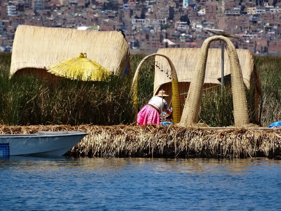
Once we arrived, the village elder, chosen by rotation among family members, explained the system used to build the islands: during the winter and rainy season, when the lake contains a greater amount of water, its pressure causes large bundles of sea bass roots lower positions; these begin to float and are used as a thick base of two meters, after which layers of reeds are added until the thickness reaches another meter. Those at the bottom, in contact with the water, will eventually rot, requiring constant addition to the upper layer. The islands are then anchored with stakes or by sinking stones tied to ropes to prevent them from drifting, considering that in this area the water is 20 meters deep. We taste the totora and it is obviously watery, without particular flavors but far from unpleasant.
Life here is quite simple, on these artificial structures where the huts rest on the soft and flexible surface of the island. The Uros live by craftsmanship and tourism, exchanging surpluses with Puno in exchange for what they cannot obtain locally: vegetables and handicrafts. They are very good at exploiting the fishiness of the lake, which hosts five different species of fish, as well as being excellent bird hunters who hide among the reeds. A very delicate aspect is represented by cooking, as the islands are still made of reeds and could easily catch fire. To avoid accidents, the stoves are placed on a base of totora roots fished from the seabed, as if it were peat, and therefore hardly flammable. There are two types of boats: simple canoes built by weaving totora reeds and larger boats that also serve for transporting bulky goods, made with the same material. These last ones, in order to float, are padded with empty plastic bottles, up to 10,000 pieces, held together by the reeds, thus combining practicality with aesthetics. The energy comes from solar panels planted near the huts.
The entire experience takes on a folkloristic and appealing aspect for tourists, but the explanations clearly convey the idea of life in this small community and how the islands are built. The one we visit consists of four settlements with a total of 22 people, while the hundred islands of Uros have around a thousand inhabitants. The main island is chosen by rotation among the families and is also a member of the Uros council, dedicating several months of the year to the community. When the population grows and it becomes necessary to create a new island, everyone collaborates in its construction; however, the problem is reversed: young people tend towards a less isolated life and readily migrate to the mainland, resulting in an increasing average age and the associated risk of extinction for this particular civilization. The Uros are of Aymara ethnicity and typically speak this language, as well as Spanish, which they use to communicate with the rest of Peru and visitors.
Navigation to Amantani and arrival with family.
The water of Lake Titicaca comes from springs located at high altitudes or on plateaus, therefore it is all drinkable and its purity is immediately apparent with a transparency similar to that of our mountain lakes, except that this measures almost 250 km in length, making it the highest navigable lake in the world, located at an altitude of 3810 meters. With a little imagination, the shape of the lake resembles a puma, a mythical animal that inspires courage and strength, while the name Titicaca in Quechua means "stone puma". It has several inflows but only one outflow, Desaguadero, which flows south-east towards the Bolivian side. Politically, Peru holds 60% of the lake, while Bolivia holds the remaining 40%. The origins of the lake are not yet certain and there are currently three hypotheses: glacial, volcanic, and tectonic.
As we moved slowly, the village elder guided us in a larger boat to another island, which was definitely more commercial, but offered some interesting things to photograph for better understanding of this strange floating civilization on islands made of reeds. At this point, it's time to board for a three-hour cruise that will take us to the island of Amantani, passing by Capachica Peninsula and docking at the small, round-shaped islet around midday. The harbor has shallow, clear waters that resemble those in the tropics. In reality, we are here, but we are also at an altitude of 3800 meters, which makes it slightly less attractive from a bathing perspective. However, we discover that the lake doesn't even freeze during the coldest months, thanks to the stronger solar radiation at this altitude. We gather shortly after the beach, where we find... gentlemen dressed in traditional attire, which are assigned to us in pairs or to entire families.
Life among the locals, Pachamama and sunset.
They all seem very similar, both in terms of clothing and physical appearance. Our host speaks decent Spanish, leads us to her home where we also meet her husband. She shows us our room, which is simple and tidy. The house revolves around a square courtyard; on two sides are the bedrooms and bathrooms, while on another side, after descending a few steps, there's the kitchen, small and dark, with only the essentials, making it impossible to find anything that isn't strictly necessary. By 2 PM, we go downstairs and find our host sitting down to... cook in a corner; it offers us lunch with a quinoa soup and grilled cheese with rice, potatoes and vegetables, followed by the traditional mate de muna.
Shortly after, our daughters arrive, school-aged, with their distinctive uniforms. We exchange a few words with them too; they are understandably a bit wary of the strangers who have entered the house, although they should be accustomed to such intrusions. However, they are polite and very accommodating in their responses. In the late afternoon, we find ourselves with our group in the main square, where the church, town hall, meeting center, and several other public buildings are located. It is worth noting that a strong sense of community is deeply ingrained in the local population, as it was also in the Inca civilization. The tourists arriving are equally divided among the interested families using a rotating system; the same applies to the crops on the island, where each of the ten municipalities that make up Amantani dedicates itself to caring for a variety each year. Everything is then divided and exchanged according to precise rules at harvest time. In turn, the land of one of the municipalities rests for an entire season so that it can better produce in subsequent seasons.
The inhabitants are primarily dedicated to agriculture, in a very poor form as the land does not allow for growing fruits or vegetables. Potatoes with beautiful white or pink flowers grow, there are 400 varieties of potatoes in Peru, quinoa, carrots, white corn and oca, a tuber typical of the Andes. In this season, the rains arrive late, so there is concern about the harvest's outcome. We cannot understand why there are no irrigation systems that draw water from Lake Titicaca. The state of poverty in which the local people live may be the reason, but we do not understand why public or community interventions have not been implemented to address this problem: nevertheless, no one has motorized vehicles. The life of the inhabitants appears to be based on subsistence; in addition to agriculture, men and women dedicate themselves to making handicrafts to sell to tourists or exchange for rare occasions when they go to Puno. When the agricultural season is slow, men emigrate to inland cities to find work that allows them to feed their families. Usually, each couple has six or seven children.
On Amantani, each community has a leader who serves for one year and a mayor to represent the island, whose term lasts four years. There is a primary school and a high school, a hospital for emergencies, but when more serious cases arise, patients are transferred to Puno. On Amantani, the inhabitants are of Quechua ethnicity, so if you need to speak with the Uros, the only way to communicate is in Spanish. Quechua and Aymara are two different languages, and they only know a few expressions. The religion is a form of Catholicism that has been implanted into the original beliefs, resulting in a mixture between our God and Pachamama, Mother Earth, who in turn represents a higher entity. What strikes and makes you reflect is the hierarchical order in which they believe: above there is God, then the Earth or Nature, and finally humans at the bottom. In our culture, even the most fervent believers can put God first, but humans come before nature.
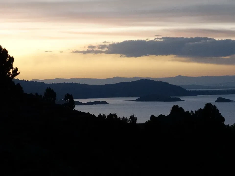
The island of Amantani culminates with two small peaks separated by only a few hundred meters. The highest one is dedicated to Pachamama, Mother Earth, while the second bears the name Pachatata, Father Sky. From the main square of the village, we set off towards the first along a perfectly paved path and among fields which reach up to the vicinity of the highest point, located at 4150 meters. It is best to take it slowly; the ascent is gentle but the altitude makes itself felt; once you find the right rhythm between breathing and steps, you can increase your pace while paying attention not to raise your heart rate too much. The heart rate does have a surge when you reach halfway and you can admire the rugged coastline along the calm waters of the lake. The sun stretching out the shadows. while it is about to sink into the distant west, it adds another touch of magic to this already magical place. full of energy.
Let's take a couple of laps clockwise around the circular wall to make a wish, as is customary locally, and then, without paying, quickly descend to enter the path that ascends towards Pachatata. Our trip is a short race against time before the sun disappears with its rays, which have now turned into a brilliant orange. The view is also stunning here, further enhanced by... sunset which creates a feeling of warmth despite being at high altitude and exposed to the wind. It's easy to imagine how past civilizations, such as the Tiwanaku and later Inca cultures, associated these places with religious aspects, likely considering them closer to each deity, a point of connection between the Supreme and humanity, using nature as an unparalleled means.
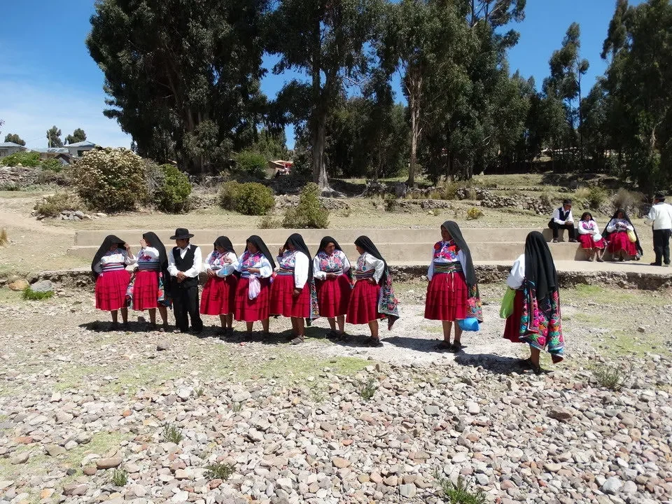
While our eyes are drawn to the left, towards that stage Still full of reddish hues that seem to ignite everything they touch, all the way to our arrival in town. Here we are greeted by the daughter of the couple who is hosting us, with whom we will return home. Despite being only fourteen years old, this young girl has a charming personality and we can have conversations on various topics while walking through the narrow streets that lead us back to our accommodation. For dinner, the convent serves a simple but tasty soup made with wheat and an omelet with rice. However, the evening is not over yet: the young girl is tasked with taking us to a party in the community hall, where a group plays traditional folk music. The show is organized for tourists on vacation on the island, but the presence of children and women wearing traditional clothing makes us think that local parties are not very different. To better integrate and make everything more realistic, before leaving home, they give us clothes similar to theirs, and once we put them on, we can feel like part of the community for at least one day. Shortly before 22:00, we return home accompanied by our companion, and we say goodbye to her in the courtyard of the house.


