Day 10
Mt. Elias N.P.
Villages and mines at McCarthy / Kennikot and down to Valdez, where the pipeline ends.
Morning on the Richardson Highway and Willow Lake
We leave early because today a long marathon is planned, which will perhaps turn out to be the most disappointing day in relation to the expectations of the eve. We savor the magical moment immediately along the Richardson, where the rising sun illuminates the forests and clearings where the lakes reflect the blue color (above all Willow Lake). A vision that calls for several photos to be taken.
However, a significant and curious episode also occurs. Traffic at that hour is almost absent and the few cars speed by at high speed. We stop on the side with the four-way flashers on to signal our presence and with the window open I take countless photos of the enchanting panorama. A car that is about to overtake us slows down and pulls up alongside. I see a guy about to say something to me and, forgetting that we are not in Italy, I think he is pointing a gun at me to ask for my wallet and anything else of value. Instead he courteously asks if we need help. We thank him showing the camera and the gentleman understands and with a smile drives away. To think that once this was the far west.
Toward Chitina and the Wrangell-St. Elias
After about fifteen miles we turn east onto the Edgerton Hwy for 33 miles, from which the glaciers of Mount Drum (3600 m) begin to be seen in the distance and in front Mount Wrangell (4317 m) with Blackburn (4996 m). We are about to enter Wrangell-St. Elias N.P. It is by far the largest park in the States, so much so that it contains 6 times Yellowstone. Less known and less visited than Denali, it has much more difficult accessibility, so much so that there are only two rather complicated road routes that can be traveled and which in any case penetrate relatively little into the interior of the park. It can truly be said that human presence is very rare.
We reach Chitina, where the trains stopped that covered the route between the copper mines of Kennicott and the port of Cordova for 60 miles and loaded goods and food for the 800 workers and their families who worked as miners. It fell into ruin in 1938 with the closure of the mines. Now there are crumbling houses and few inhabitants.
McCarthy Road and Copper River
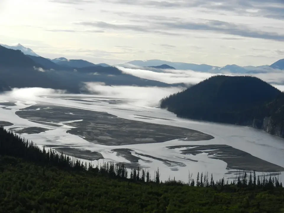
From here, we travel the bumpy McCarthy Road eastward, a road built on the path of the old railway that winds along the splendid Chugach Mountains and the wide Copper River toward historic McCarthy. The journey from Chitina takes two and a half hours one way and has the flavor of eternity. On rare occasions one manages to touch 30 mph, more often one is forced to try to avoid potholes or not get stuck in the mud. In these cases one does not exceed 10/15 mph.
In reality the road would not be so bad, it only depends on the vehicle with which one tackles it considering the length (in total there will be 200 km of dirt). To turn the track into a cart road, the sleepers were covered with earth and stones. Over time the surface wears away, causing the bolts that held the sleepers together to emerge.
Kuskulana Bridge and arrival at Kennicott
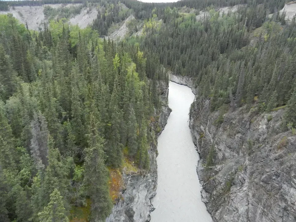
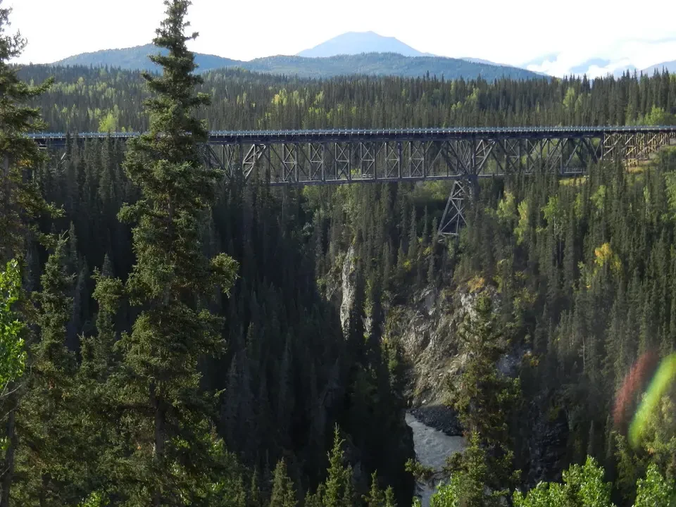
The Kuskulana Bridge, a bridge 160 m long and 177 high, takes your breath away at the moment of crossing it. It has been made safe and guardrails have been installed, but the view of the canyon opening below convinces you to stay focused on driving. There is also an old disused wooden railway bridge and a whole series of beautiful views of the gray river from glacial melt below that will join the Copper River, which flows into the Pacific at the height of Cordova.
We park in front of the inevitable Visitor Center and walk the half mile that leads to the pedestrian walkway over the Kennicott River. In 1893 the inhabitants stretched a steel cable over the river and installed a pulley crossing system, which remained in operation until a few years ago. At 11 we take the shuttle that travels the 5 miles to Kennicott, reaching it around 11:30.
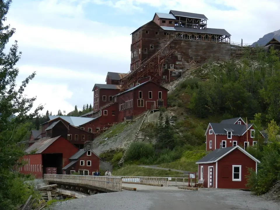
It is a ghost town abandoned in 1938 and stands in the national park. It is located on a slope directly above the Root Glacier. Both localities were born following the discovery of what were the richest copper deposits on earth. More than a town it can be considered an agglomeration of buildings used for copper extraction. What remains is quite in ruins, although interesting, and one hopes that the restoration work in progress can intervene before the collapse of the slender wooden structures.
In the cliff below the town there is a real dump where iron and wood once used for constructions reign, to which from time to time are added the wrecks of something that in the meantime has fallen into ruin. What was the power station is in good condition and inside you can still see the boilers with which the energy necessary for extraction was produced. Those who worked there were considered lucky because they could operate in a warm environment, while outside the temperatures dropped to abysmal levels. There was a fire in 1924, but the interventions were very rapid because the plant was essential for the functioning of both the mine and the movement of the mineral.
From McCarthy to Valdez
There are not many people around even though it is a tourist location quite recommended by guides. In reality there is not much to see compared to the effort required to reach it. The weather turns bad when we decide to take a walk to Jumbo Creek, a panoramic point to observe the Root Glacier below us. There is also a moment of suspense when some hikers coming from the opposite direction inform us that there is a large black bear (someone even speaks of a second bear) wandering in the area. We proceed paying maximum attention trying to speak loudly in order to signal our presence. We only meet other walkers who confirm the sighting but fortunately for us no bears are seen.
The relationship with bears is one that proves quite complicated: on the one hand we would like to see them to be able to immortalize them and get to know them better up close, on the other when we travel trails on foot a certain attention is necessary so as not to surprise them. If they attacked we would have very few possibilities of defense. Certainly we do not dream of feeding them since the fine amounts to $500.
On the way back we take a tour of the town of McCarthy and we can only say we are disappointed. Once it was the town that provided services (to be understood also as alcohol and women) to the miners stationed at Kennicott. Now there are a few houses, some of which are quite dilapidated. There is nothing that catches the eye except some artists who demonstrate their extravagance by coming to practice here. A couple of gift shops complete the picture. Spending a day there can turn out to be an experience even longer and more exhausting than the journey on the namesake road with its 60 miles of dirt.
The road we will immediately undertake next and that will cost us another two and a half hours of patient driving. Arriving at Chitina one would want to get out to kiss the asphalt, instead we do a few hundred more meters of dirt road to better see the fishwheels (see Nenana area) on the Copper River.
After having traveled back the Edgerton Rd. we continue on the Richardson Hwy. We still have 72 miles to Valdez along an incredibly scenic road. We pass Pump Station No. 12, the last in the series encountered starting from Prudhoe Bay, along the Trans Alaska pipeline. The weather is not bad but there is no sun and this does not contribute to giving liveliness to the panorama.
When fatigue seems to surface, at mile 28.6 we find ourselves in front of the imposing Worthington Glacier, which seems to block our way. Fortunately then the road deviates and avoids it, but the mass of glacier just before Thompson Pass remains remarkable. If it has retreated as many others have in recent years, one wonders how far it reached before.
It is now 7 PM and the weather shows us all the possible characters of variability. Here the pipeline passes underground on the track discovered next to the road. All around there are still quite a few snowfields, being an area where it snows a lot and where it probably also rains a lot, receiving the humid air coming from Prince William Sound. They speak of snowfalls that are around 600-900 inches per year (15 – 20 m). The area in fact holds several world records in terms of annual snowfalls, in the course of a day, etc.
At the pass the clouds are just above us, in fact at the summit point we find ourselves in a stretch of fog where visibility disappears completely. We emerge on the other side, the one that leads to the Sound. Patches of blue in the sky alternate with cloudy stretches and let an idyllic landscape shine through below us on the descent toward Valdez. What could be considered the gateway to Valdez is Keystone Canyon, where the Bridal Veil and the Horsetail Falls are located, two beautiful waterfalls that seem to act as curtains to such a gateway.
Once past the narrows at the bottom of the road that descends from Thompson Pass, a plain opens in front of us that slopes toward the sea, where that gem that is Valdez is set. Shortly before 8 PM we are at the B&B that will host us tonight. Here too the lady is absent but on the door there are all the indications to access. We call the owner to signal our arrival and she reaches us in a couple of minutes. It is a richly furnished house that we will share with three girls from Madrid, who sleep in the adjacent room.
Evening in Valdez
We dine at the Totem Inn with fish (halibut and salmon), good quality but cooked with little imagination. The town is small as we expected, with a nice harbor for pleasure boats, but has a truly enchanting position. Regarding the weather it probably does not have the same luck, sharing the fate of the other towns of Prince William Sound (Cordova and Whittier) rich in rain and fogs. The fact remains that its are among the few waters free from ice all year round even if in winter an average of 9 m of snow falls there, while in summer the thermometer reaches a max of 16°.