Day 2
Flying Denali
In search of gold at Hatcher Pass and angel flight over the Denali mountains from Talkeetna.
Morning on the Glenn Highway
We don't even give the alarm clock time to do its job and at 6:30 we are already up, ready to go. It is also true that last night we went to bed early. A frugal breakfast in the room taking advantage of the fact that we can make coffee on site and off on the Glenn Hwy to see the Musk Ox Farm from the outside, a musk ox breeding farm that will only open later. We see these strange bovines from outside anyway, inhabitants of the Arctic lands and capable of surviving extreme conditions thanks to qivut, a fur as fine as it is thick, which is used by the Indians to create very warm garments. It costs a fortune because the yield is low and requires a lot of processing.
Susitna River and Chugach Mountains
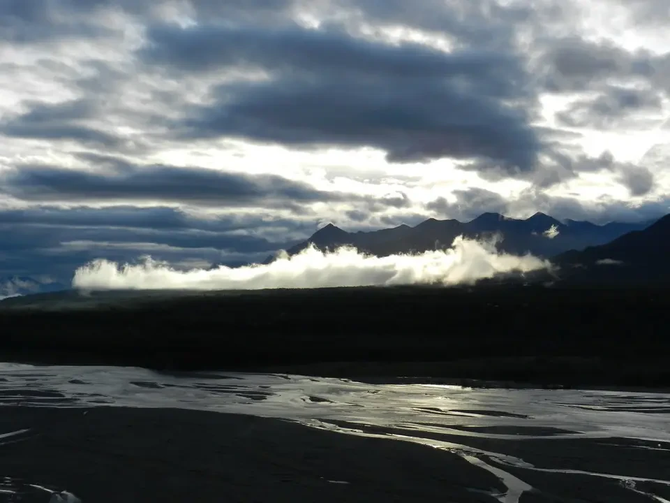
As we proceed we stop to admire the wide bed of the Susitna River from a high observation point, with the Chugach Mountains in the background. Many rivers have created large alluvial spaces in which they end up flowing impetuously inside a narrow bed. Probably in spring they give vent to their majesty, occupying most of it.
Independence Mine and Hatcher Pass
We climb toward Hatcher Pass from Wasilla-Fishhook Rd, a 49-mile road that crosses the Willow mountains, passable between the June thaw and the first September snowfalls. We spend a couple of hours profitably visiting the Independence Mine State Historical Park. There was a large gold mine here, abandoned in 1955. It was the second in Alaska for production. The place has now become a museum and with the help of explanatory signs you can understand the life and work of the miners. Particularly difficult conditions in winter due to snow and low temperatures.
We then climb to Hatcher Pass at 1,184 m and from there continue on foot on the April Bowl Trail to reach Hatch Peak with an elevation gain of 300 m. The altitude is around 1,500 m and the view ranges from the Willow plain to the west to the Mat-Su plain to the east. The Alaska Range and Denali are instead partly obscured by clouds. At the top we meet a nice couple of young people from Oregon and from them we learn that they have recently been in the Gran Paradiso group, while a golden eagle circles above us in search of prey smaller than our size. Descending from the pass on a dirt road we return to see vegetation consisting essentially of birches with dense undergrowth, whose limit reaches approximately 850 m altitude. Beyond there is space only for shrubs and finally for mosses and lichens.
Lunch is one of those casual ones, near a stream that descends impetuously, with prefab ham from who knows what chemical plant. Along the road we see some people intent on panning for gold in the streams with the appropriate pans. There are also many signs prohibiting gold prospecting in the streams since licenses have been granted to private individuals.
Toward Talkeetna
We pass through Willow without even stopping and take the George Parks Hwy north to go up to Talkeetna under a clear sky. Famous gold prospectors' trading station between 1800 and 1940, the village is the base for expeditions into Denali and in particular to McKinley. Along the road it is not difficult to find the right frequency that tunes the radio to country music to provide the soundtrack to the surrounding environment.
Flight over Denali and glacier landing
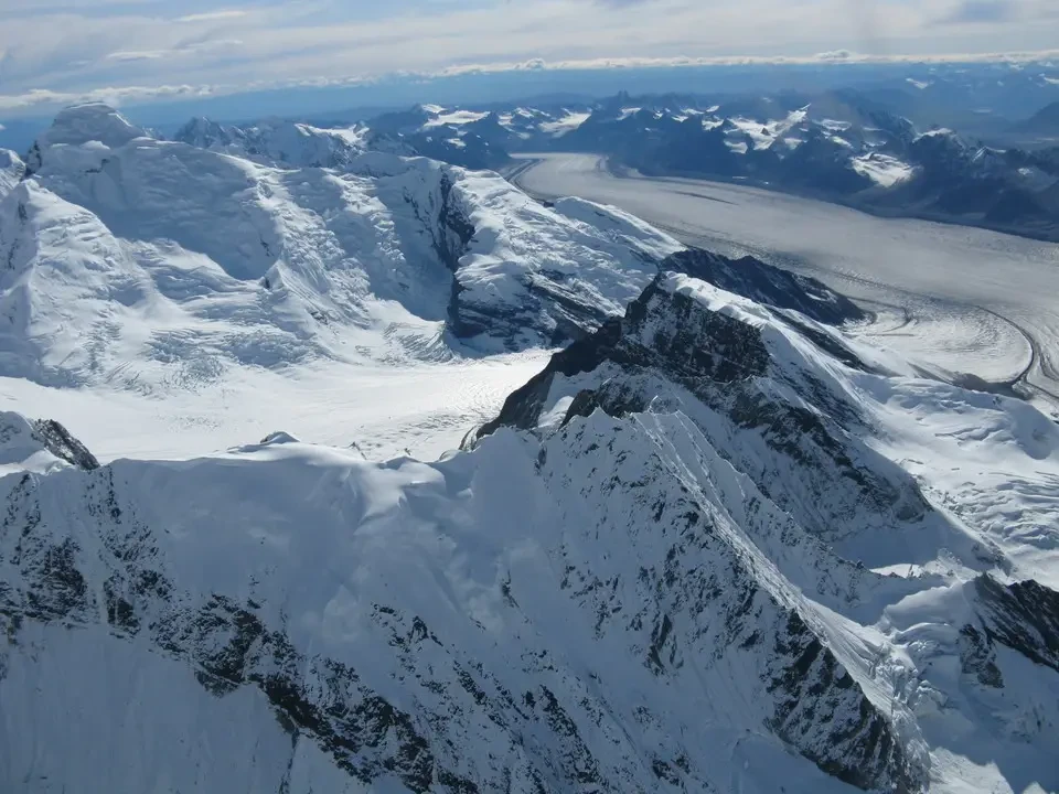
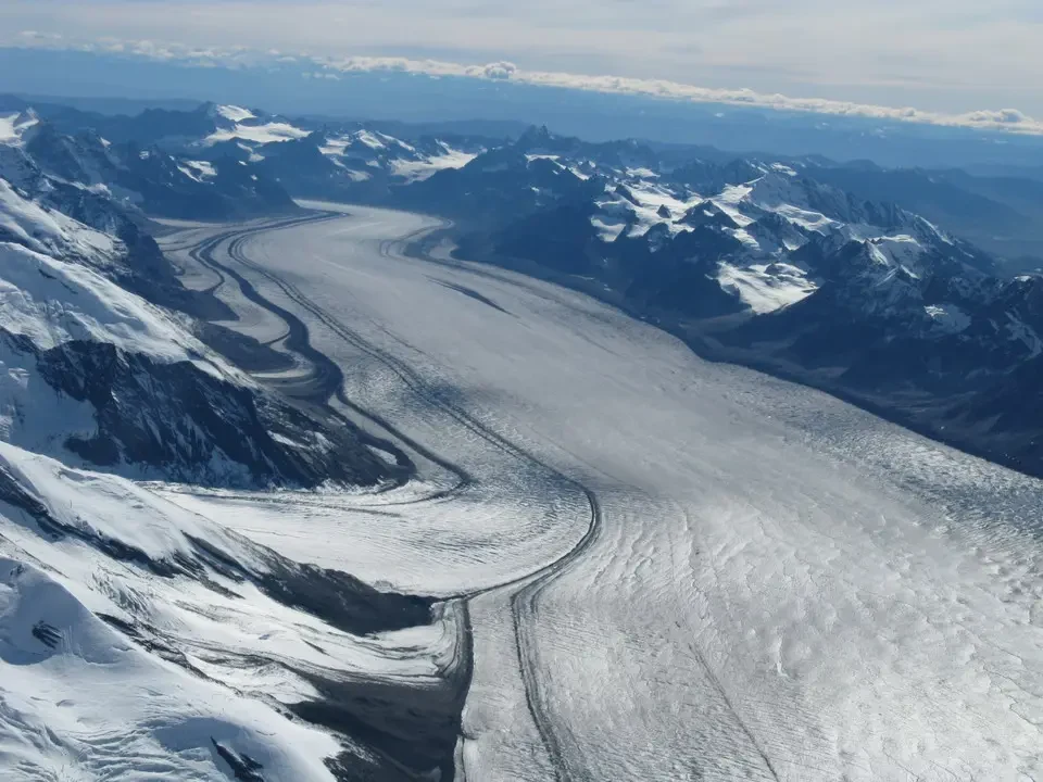
The background begins to be dotted with snow-covered peaks that shine under the sun's rays and a strong itch assails us: the beautiful day would lend itself to an aerial tour around the peaks of Denali. Determined to seize the day we head to a company, which tells us that there is only space left at 6:30 PM, but Air Taxi has space in half an hour: deal done and shortly after we put on the overboots to be able to descend onto the glacier. In reality our ambition was limited to the view from above, but we were offered a free upgrade to join a group that had also chosen the glacier landing. All for the equivalent of 120 € and a duration of an hour and a half.
Already shortly after takeoff with the small 10-seat plane we begin to widen our eyes at the sight of the ground we have just left. At a few dozen meters of altitude we begin to see the wide beds of three rivers that meet. It is a very characteristic area and therefore difficult to travel by car. Even though the Talkeetna, Susitna and Chulitna rivers have considerable but not large flow, their bed has a width that exceeds one km.
We climb to a maximum of 3,200 m while the glacier landing takes place at around 2,300 m altitude. It is an experience that is exhilarating to say the least and humiliating to say the least: exhilarating because wandering among those ice-covered peaks and the glaciers tens of km long is an emotion experienced rarely in the past.

Talkeetna and the road to Carlo Creek
At the same time it is humiliating to face the mountain in this way, like tourists unable to face its asperities and instead inclined to the comforts offered by progress. In substance a really good moment, but it was not true glory. And may McKinley forgive us, if we descended to this compromise it is because we were not able to face it in mountaineering style. At 5:30 PM we are back at the Talkeetna base.
We briefly stop at the cemetery where the tomb of Sheldon is located, one of the most famous Alaskan aviators and perhaps even of America itself, who earned his fame in rescues of mountaineers injured at the limits of the impossible. There is also the plaque that remembers all the mountaineers who fell on the mountains of Denali, listing their names.
We cross the village of Talkeetna pursued by the haste not to arrive too late at tonight's accommodation. In reality it is a disappointment: we expected a far-west style town, but it is an agglomeration in which disorder and pseudo-artist boutiques retired to these parts reign. It consists of four streets, of which three are unpaved and muddy. The rest is made up of alternative longhairs who have now had their time.
It would instead be worth stopping continuously along the 125 miles of Hwy that take us to Carlo Creek. The setting sun's light makes the colors even warmer and every corner would be worthy of a postcard. The tall vegetation that runs along the road often prevents seeing beyond, but the peaks of Denali stand out clearly to the north. Skirting Denali State Park we reach Cantwell, from where Denali Hwy 3 branches off eastward, and Broad Pass, actually a plateau at 850 m altitude that we cross almost without noticing when it is already 8 PM. The silhouette of the last isolated pines in the surrounding nothingness stands out against the sun that is about to set, when we are still about twenty miles from Carlo Creek.
Carlo Creek Lodge
We reach the campground where we had booked a log cabin (bungalows built with horizontal stacked wooden logs). It is characteristic because it has a roof covered with vegetation and there are even some small trees whose height exceeds one meter. The services are located about fifty meters away which must be traversed paying attention to the moose that occasionally wander there, and have already left their tracks on the ground. The night passes in maximum tranquility after a pleasant dinner in a tourist but captivating place. After all, besides the tourists who approach Denali, those who live there cannot find anything else economically attractive to live on.
Noted the presence in the restaurant of several Italians, who booked through booking in a center located nearby.
Alaska's Wildlife
Brown bears are present throughout the State fairly uniformly. Black bears are also present everywhere except the North Slope, the only region where polar bears live instead. It can be said in substance that in every region at least two species of bears live.