Day 6
Arctic Deadhorse
Flight to the Arctic: Deadhorse, the Prudhoe Bay oil fields and the ocean
Toward the Arctic along the Dalton Highway
This time we had to compromise with an organized tour because visiting the Arctic on your own is quite difficult. The Dalton Hwy is certainly not suitable for the transit of normal cars. The road surface is not the best, and if you consider that it is more than 600 km in this state the thing becomes impossible. Moreover the rent a car companies that rent normal cars do not allow use on dirt roads and one would need to equip oneself with a specially equipped off-road vehicle.
It is in fact necessary to have an additional spare tire and some spare parts to be able to intervene if necessary. Asking for help along a stretch without services for 240 miles can be quite dangerous. It is also obvious that the GSM network does not work, therefore a safety standard would require having a satellite phone with you. All feasible things but extremely expensive. In addition with this tour we can go by plane and return by minibus, being able to see everything from two extremely different angles. With the help of weather luck this will be precisely the right move of the whole trip.
The aspect we like least is instead the cut that was given to the excursion. As we could imagine we are the only ones who are excited about finding ourselves in such a wild world, while the organization provides a whole series of idleness that does not suit the magic of the place. After all, those who participate in it normally belong to the species of tourists and not that of travelers. Even our group is basically represented by individuals little devoted to adventure and rather inclined to comforts. We have difficulty bonding with the others precisely because of the different inclinations that brought us here.
We remain totally indifferent to the sirens of the gift shops that instead attract the few who have dared to seek the Arctic. Being able to have reached the ends of the earth to see a nature so intact, with a few exceptions, represents for us an opportunity that we consider unique and a privilege that must be fully seized. The thirst to see and understand becomes almost maniacal, every moment must be dedicated to learning how life unfolds in these parts: starting from plants, then animals and finally men. Places where individuals must often defend themselves and even fight against nature to survive, in an optics diametrically opposite to ours, where it is weakened and stringent limits must be imposed.
In flight to Deadhorse over Yukon and Brooks Range
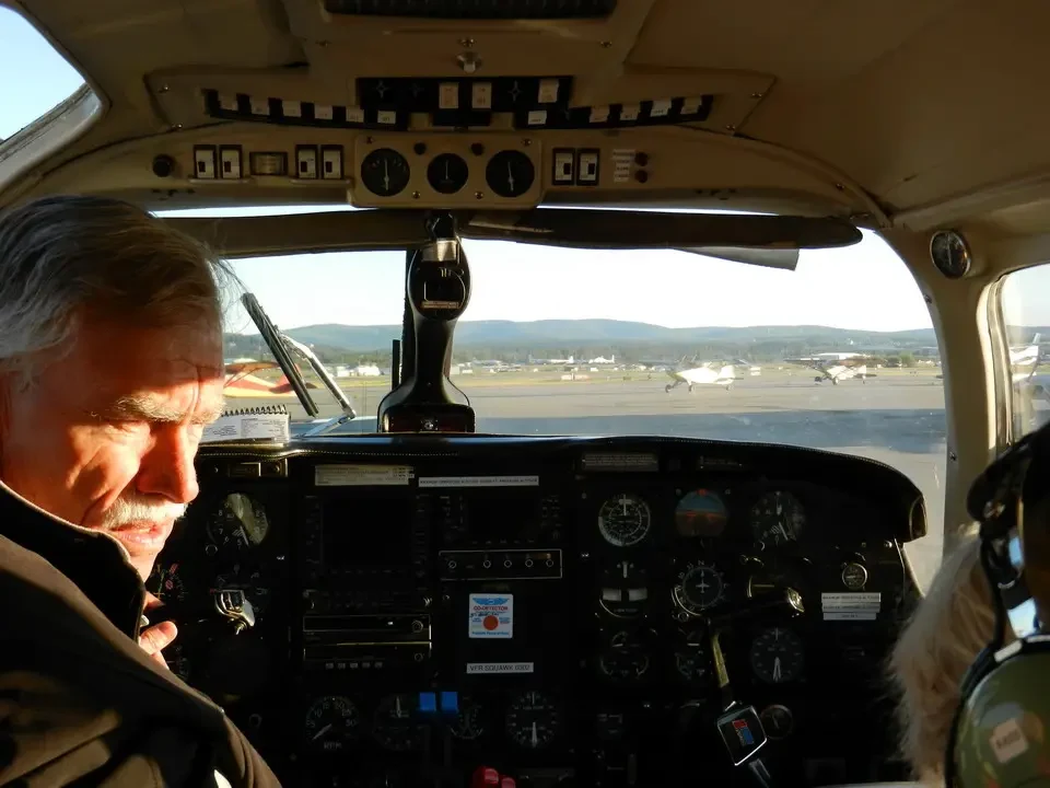
At 7:30 with pilot Bill and 3 others from our group we take off for Deadhorse (70° north latitude) in a flight that is still an understatement to call unforgettable. You can clearly see how Bill knows how to maneuver the Piper with dexterity, making the plane sway now on one side now on the other to allow better viewing of the landscape below.
In 2 hours we are at the destination airport flying at an average height of 3,000 m when we have to pass over the Brooks Range, otherwise the cruising altitude is around 2,000 m. The sky has no clouds until near the coast, where there are the classic fogs that today fortunately are not very thick and allow a quiet landing. A strong and icy wind in the afternoon will also take these away, however contributing to further cooling the climate.
Along the journey we cross the Yukon, whose length exceeds 2,200 miles and which on Sunday we will cross on the only bridge that is in American territory (the other three are in Canada). The view from above offers the spectacle of the great river flowing slow and sinuous with a whole series of meanders around it. It has a very large basin that collects all the waters that descend from the Alaska Range to the south to the Brooks Range to the north. Crossing this last chain allows us to see from above mountains not as high as those further south but still rich in glaciers, also given the latitude. Even in these parts people talk about glaciers in constant retreat, as in the rest of Alaska.
North Slope and arrival at Deadhorse
Everything that is north of the Brooks is called North Slope since it is precisely a slow and constant descent that slopes down toward the Arctic Ocean, where all the waters flow. The chain represents only a third of a longer cordillera that forms a cap for North America. The remainder is in Canada.
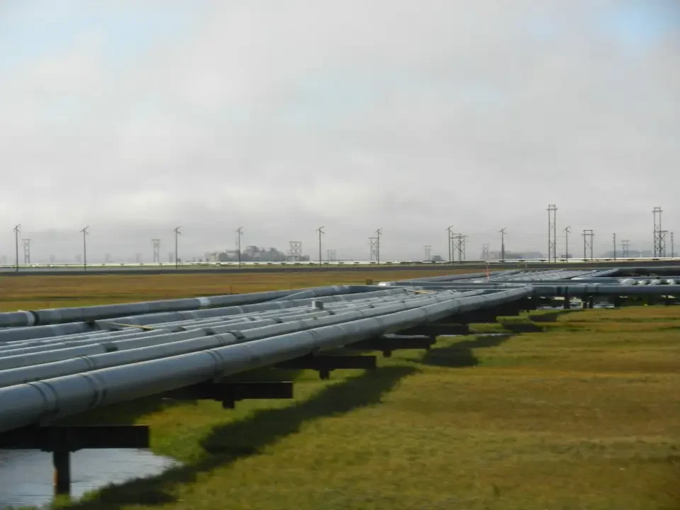
Along the journey we also overfly some gold mines located in an almost inaccessible position in the middle of the mountains. Precisely the position, together with the fogs that often loom, caused two planes to miss the small runway, whose wrecks we see below us. A bad omen for those on a similar aircraft, softened only by Bill's voice who reassures us that Deadhorse airport is easier to approach. In the last stretch we clearly see two parallel straight lines cutting the ground: one is the Dalton Hwy, the other is the pipeline that carries oil south.
Deadhorse, extreme oil field camp
Deadhorse is a village that could easily be on the moon or on another planet. It exists as a service center for the Prudhoe Bay oil facilities, from which America obtains much of the oil it needs. Here the field workers live and the winter vehicles are parked. Although it is an area with scarce precipitation, in winter (that is for about 8 months) traditional vehicles are not used, but strange vehicles similar to snowcats, with special tires that replace tracks, capable of moving easily on snow-covered surfaces. Some are real pickups with rubber tracks. In some cases, to harden the ground water is spread which freezing creates a layer as if it were asphalt. This system is regularly adopted on the Dalton Hwy.
At the airport we are picked up by the minibus with which we will continue the journey, which shows a temperature of 34° F (corresponding to +1.1° C.). In case we had not yet understood we are in the Arctic. But in Fairbanks they told us that the winter rigor is felt more there than on the coast, where the ocean slightly mitigates its reach. What makes the difference is that here blizzards sometimes make the climate at the limits of survival.
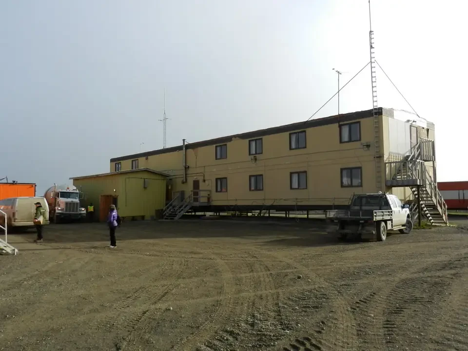
We are transported to our hotel accommodation a few km away. These are containers converted into bedrooms, which in other seasons are moved and used on the pack ice to host scientific researchers or operators inside the oil fields. We understand from the beginning that at dinner we will have to drink little. Not so much for the alcohol risk: the area is so-called "dry". This means that the sale and consumption of alcoholic beverages is prohibited. Probably the first beer is at least 300 km away.
We are taken on a tour of the facilities. First stop is a room where a short film is shown that illustrates the history of the oil fields, how they were discovered and the importance they have for the economy of the United States. Great emphasis is placed on the measures taken to protect the environment and it is underlined the well-being created in the population, first of all the natives. After this briefing in the arctic room we are ready to leave.
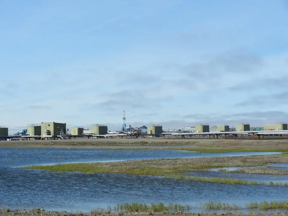
Contrary to what we thought Deadhorse is nothing more than a camp with a very limited surface compared to Prudhoe Bay, whose extension occupies the entire coastal strip and penetrates for some km inland. It is a real Gruyère of drilling stations that extend as far as the open sea. Access to the latter and consequently to the ocean is in fact forbidden to private individuals, one must obtain permission and one can only go in groups accompanied by the staff.
While it is true that with the times we live security measures are never too many, the whole thing smells of big lobbies and the will to prevent uncontrolled intrusions. Suffice it to think of some ecology extremist without having to get to real terrorism. In this kingdom BP plays the lion's share, but inside there are also Shell, Exxon and Conoco Phillips. Even seeing the fields limited to what is granted to us, it is inevitable to intuit what interests are at stake and what political-economic lobbies interact and govern them. The impression one gets coincides with that of the imperialism that many have of Americans, in stark contrast to the high standards of civilization and respect that instead characterize individuals.
But let's return to our adventure in the north of the north. With the Arctic Ocean Shuttle minibus driven by a diligent local ranger we pass the access checkpoint with the order that it is forbidden to film it. We wander among what are called DS (Drill Site) and points where the gas sucked with the oil is re-injected into the subsoil. The pressure of the gas thus injected will increase the rising pressure of the oil. At the same time the gas stored in these natural underground containers represents a bank from which to draw when the occasion arises.
Everything is connected with gas pipelines or oil pipelines that converge at pump station nr. 1, from which the pipeline that arrives at Valdez starts. From the outside it is all a network of conduits and suction or pumping blocks. Drilling is essentially carried out in winter, as well as work offshore, taking advantage of the frozen sea and therefore accessible with vehicles equipped with special tires.
We finally reach the Arctic coast which extends as far as the eye can see. At this moment the pack is several hundred km away, also by virtue of global warming which increasingly moves the limit of the pack ice away. In these places there are currently polar bears. We are told that the plantigrades do not frequent the area much even in winter, or at least not as in Barrow where they are literally at home. The wind is icy and the perceived temperature could also be below zero.
In winter the sea freezes for about 15 ft. (4.5 m), forming a single plain that unites mainland and sea. To get here there are three possible ways: the Dalton Hwy by land, by air or by barge circumnavigating Alaska. The latter system is used for the heaviest transports but the season lasts at most two and a half months and therefore serves for the transport of bulky infrastructures to be assembled on site. On the gravelly coast there are many logs now smoothed by salt: we are told that they come from Canada carried out to sea by the McKenzie and then back to shore by the waves. Shortly before arriving at the sea we encounter large accumulations of gravel, they say it is contaminated by oil but it is not clear if they are sediments extracted with the liquid mineral or if it is the consequence of disastrous leaks or other incidents.
Industrial activity began in 1968, while toward the mid-1970s the pipeline became operational whose construction lasted 5 years and represented the largest private investment in the history of the oil sector. It is still one of the largest suction sites, provides 40% of the oil needed by the USA and a good percentage of gas. Before the deposits were exploited industrially the Indians already drew from the outcrops to collect the flammable liquid and use it for combustion in lamps.
Ironies of the north: the Deadhorse National Forest
At least on paper great attention is paid to the safety aspect against possible pollution. There is a group specialized in identifying and remediating oil leaks, which has sophisticated equipment for intervention at its disposal. At the same time each area has a group of firefighters. There is also a first aid medical center, in case of more serious accidents a doctor is immediately sent from Anchorage who takes care of putting the injured in condition to be airlifted to Anchorage itself or to Fairbanks.
In an attempt to give a sympathetic appearance to the agglomeration where no shrub grows more than a few tens of centimeters, the Deadhorse National Forest was created, consisting of three trees made of wooden planks and painted green. Above it the name of the sponsor, one of the companies operating in the area, seems to belong to Dick Cheney, the former vice president of George W. Bush.
Near the Arctic coast there is an area of sandy dunes where in winter grizzlies come to dig dens and create a shelter for winter hibernation.
After a couple of hours the ranger takes us back to the Caribou Inn where we had met and so ends the tour of the oil facilities. A tour of sure interest in which we were provided with interesting notions of an activity never seen before. The whole thing took place in a way attentive not to provide information that could in some way contrast with the interests of the companies and under the watchful eye of who guided us. After all, the strategic sensitivity of the place and the potential risks to which it is subjected must also be understood.
With us there are also three intrepid motorcyclists (among whom there is a woman) who have traveled the entire Dalton Hwy. They say it is not particularly difficult, the only big problem is having to stay concentrated on the road you have in front of you. A minimal distraction and you end up unseated, maximum attention for a dirt route longer than the one between Turin and Rome round trip. One of them (they are all on BMW) has traveled the route by motorcycle from the extreme southern point of the USA in Florida to the northernmost. It is 5,500 miles, much more than the famous coast to coast that extends from east to west.
Evening in Deadhorse
Returned to our compound for a simple but pleasant buffet dinner in the prefabricated structure that serves as a refectory, before going to rest we think how nice it would be to see the sunset, which these days arrives very late although it no longer reaches the so-called midnight sun, at this latitude visible for over a month. Everything leaves us thinking well until around 10:30 PM the fogs descend that bring a minimum of darkness, preventing us from seeing the ball of fire sink in the west. Probably at night it will never become completely dark, but we do not contemplate for all the time and we take advantage of it for a restorative sleep in one of the northernmost communities in the world. After all we have enjoyed plenty of clear sky today, in one of the rare serene days of this extreme part of the northern hemisphere.