Day 7
Dalton Hwy I
On the Dalton Hwy: North Slope – Brooks Range – Coldfoot
Return south along the Dalton Highway
Having now reached the point beyond which one proceeds only by water, we undertake the descent south which will require two days to reach Fairbanks along the 666 km of the Dalton Hwy through desolate lands.
Sag River Overlook and the Arctic wetlands
At 8 we are ready to leave south when the day is as we left it last night. The whole thing gives hope, so much so that after a few km we leave the meteorological border area between land and sea to meet in the interior a cold sun that will accompany us throughout the day. We stop in a lay-by where there are tents and caravans of hunters: at this time the caribou hunt is open. At a certain point a pickup arrives with a freezer on top to stow the meat and then transport it.
We also stop for a moment at the Sag River Overlook, a panoramic point on one of the many rivers that flow directly north, at the height of pump station nr. 2. Here 60 people work and there is 24h surveillance.

The vegetation consists of simple shrubs and a moss so thick it appears almost rubbery underfoot. The landscape continues quite monotonously. The whole area is full of marshes and ponds, which represents a paradox since precipitation is extremely scarce, only 13 cm of rain per year. However the water cannot drain due to the fact that the permafrost does not allow passage into the underground layers, with the consequence of remaining on the surface. The area is therefore called wetland even though it is not very rainy. Contributing to the presence of marshes is also the low evaporation due to low temperatures. In the months of June and July there is a real proliferation of mosquitoes and small black flies, which remain harmless. Such situations are the source of further specific phenomena of cold lands, such as pingos.
Galbraith Lake
As we proceed the first mountains of barren rock and totally devoid of vegetation begin to appear on the horizon. Frugal picnic at 2 PM near Galbraith Lake, after having accepted long waits near the alternating traffic because road surface maintenance work is in progress.

Along the Trans-Alaska Pipeline
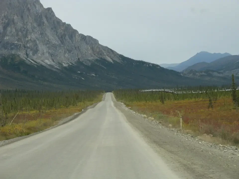
Along the entire route the road runs parallel to the Trans Alaska Pipeline, which every now and then disappears underground or jumps from one side of the road to the other. Although in appearance they may seem meaningless, these are nothing more than a series of measures to keep the temperature constant as well as protection against the frequent earthquakes that hit Alaska. One of these is precisely the zigzag construction. It is also made to pass underground when one is in avalanche risk zones or near pumping stations.

Atigun Pass and the return of green
We reach the highest point on the Hwy at Atigun Pass at 1,444 m which is also the highest road pass in all of Alaska, as well as the continental divide between the Yukon basin and the Arctic basin, where a few years ago the pipeline lost quite a bit of oil. It is not known if the cause was accidental or intentional. Landscape-wise it is not very beautiful, given the roughness of the terrain, but pleasant valleys open on the two sides and near the road we can spot a group of Dall sheep intent on grazing the little grass available.
It must be considered that the altitude in relation to the latitude certainly could not have us find palm trees. Although it does not have the hairpin bends that characterize our valleys, one wonders how trucks can climb along this road in the winter months. We do not even dare to think how a minimal accident could have lethal consequences in these extreme conditions.
South of the pass, as we descend the green color begins to be seen with greater insistence. It is no longer only the mosses and shrubs that rule and the landscape becomes more varied. The coniferous forests in the distance make the panorama more varied and animated, in the classic style of North American valleys. Also the peaks are more plastic and less barren compared to the north. The streams that descend impetuously bring with them crystal clear water. If only the thin but annoying blanket of high clouds would leave space for the sun, the whole thing would render a paradisiacal image.
Last Spruce and the return of the forest
Next we stop a couple of times at Chalander Shelf and at the height of the Last Spruce, the last spruce, that is the one that represented the northern limit of tall vegetation. There is a sign placed to highlight this pioneer of spruces, which has not feared the cold for so many years but was killed by an idiot who took it with axe blows. Certainly we cannot understand what faults can be attributed to the poor tree that had had the destiny to be born and survive further north than the others of its species.
We meet hunters hunting caribou. They are armed with crossbows with relative arrows and explain to us how within a 5 mile band around the pipeline one cannot hunt or simply use firearms. Here and there one sees tents placed in the middle of nowhere waiting for the evening return of the devotees of the hunting activity.
The vegetation begins to tend toward yellow, clear sign that autumn will not be late in arriving, although we have just passed the middle of August. It is surprising to note how everything here is forced to concentrate its activity in the short summer months, so as to be able to complete its cycle before the frost returns to take possession of everything. The road is entirely dirt, in stretches where one can even reach 40 mph (the bold truckers with their trucks even reach 50) alternate with infernal pieces. So much so that next to the pickups and off-road vehicles one does not see traditional cars.
Coldfoot Camp
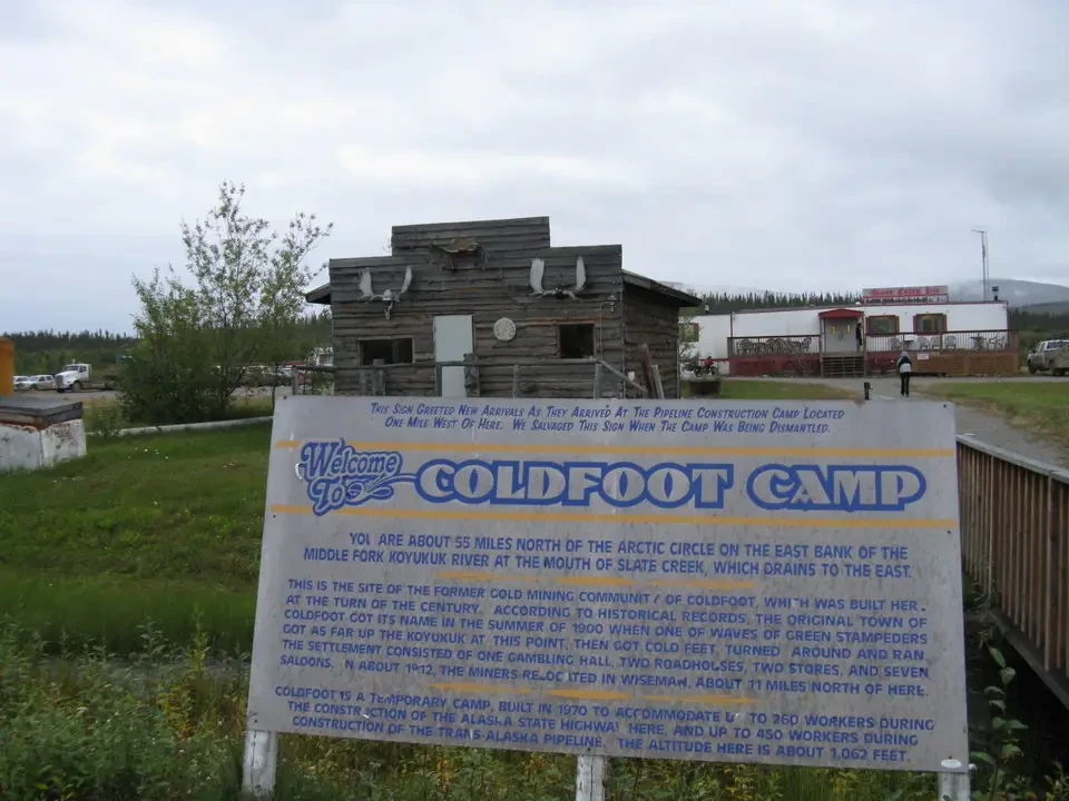
We arrive at Coldfoot when it is already evening with a final stretch consisting of 15 miles of asphalt that begins at the height of Wiseman. A true godsend for our backsides. Previously we had already encountered some miles at the height of pump station nr. 2. We settle at Coldfoot Camp, the only or among the few accommodations available within a radius of hundreds of miles.
We dine in a very original saloon that really smells of last frontier. It does not need great fictions as happens elsewhere to simulate the far west, it is enough that it remains as it is. In effect Coldfoot is nothing more than a large service station placed halfway between Fairbanks and Deadhorse, where all the trucks stop to refuel and refresh themselves.
I have a moment of panic at the idea of having to spend another evening without an Alaska Amber, the fresh (and we would need it!) local beer. They explain to us that beer cannot be served in the room where we are but only in the adjacent one. We move willingly. All-you-can-eat buffet dinner with excellent meat and vegetables, unthinkable at this latitude and in this desert of humanity. The rooms are decent but nothing more, after all we cannot expect great things from a place like this, in the middle of nowhere, traveled all year by trucks and only for a short season by tourists.
If it changed it would lose its charm, something we notice instead in the Visitor Center. It is a real cathedral in the desert, albeit of excellent workmanship and with wooden architectures that integrate well with what surrounds us. Keeping in mind that it is operational only for a few months a year, the impression remains that of a waste of money made possible only by the wealth generated by oil.
After dinner we take a couple of steps to visit it, tonight there is a pleasant lecture on how to learn from animals to survive the crisis. Never more would we have thought of such an interesting topic treated in a place that we can define off the map, without fear of contradiction. A brilliant speaker, with the help of slides, explains to us how caribou defend themselves from adverse seasons by migrating, bears by going into hibernation, the strength of wolves is instead that of gathering in packs and in this way being able to hunt better and therefore survive, snowshoe hares and fireweed at the end of the season dry up to leave space for new generations in the next spring. It is the paraphrase of going into retirement.
Returning toward our room we see the hunters' pickups loaded with prey in the large freezers they have on board. That the hunt went well we intuit from the tangled antlers on top. There is even a helicopter parked in the large spaces in front. But it is known that in America everything is big.