Day 8
Tikal
The Mayan city nestled in the jungle, where history and legend meet.
Tikal: in the jungle of Petén.
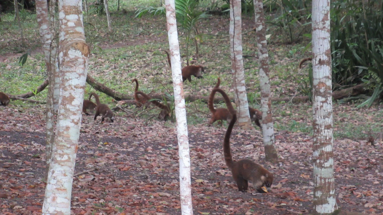
Flores is located in a definitely fortunate position, but no one would come to this remote area in northeastern Guatemala, just a few kilometers from the border with Belize, unless there was one of the most important Mayan sites nearby — the second after Chichén Itzá in Yucatán. We provided breakfast, which we ate in the hotel's breakfast area where you can already get coffee; shortly before 6:00 am, we were with a group of explorers like us, ready to cover the 65 kilometers north that, bypassing the lake Petén Itzá, leads to Tikal. A very peripheral area, both in terms of natural configuration and transportation routes, which we decided to reach by plane to save time, disembarking later on foot to explore it more calmly. It is literally a tropical zone, with rainfall that can reach nine months per year and consistently high humidity levels. There are approximately 17 million people living in Guatemala, almost half of whom are Maya and the other half are mixed-race. Strangely, there are no volcanoes here, so we are not in a seismic zone: the areas at risk are located inland, parallel to the Pacific coast – like Antigua – and in the Caribbean plate area to the north, towards Honduras. This caused migration from populations living in the Antigua area, which is more fertile but extremely risky. We were favorably impressed by the fact that visitors are essentially young people on a budget vacation: we expected a more senior audience for a site of this kind. Congratulations to those who have undertaken this trip, although it does not only offer Mayan ruins. The classic tropical humidity leaves some morning mist, which is quickly cleared by the first sunlight. Along the road, in a village, we meet our guide – an enthusiastic local who will provide us with all kinds of historical and cultural information. After arriving, stamping our online tickets, we set off to explore the site. Before walking along the long avenue through the jungle that serves as access, we encounter a group of red coatis, playful animals with long tails. The attention is also drawn to some trees, particularly a Ancient Ceiba tree... the national tree of Guatemala. Tikal was discovered by rubber collectors – but these people didn't pay much attention to the ruins, which were completely covered in earth and vegetation. The Maya who lived in Tikal came from the north, from the Yucatán area, driven south by Aztec conquests. They formed a compact empire and had no difficulty overcoming the neighboring Mayan cities. The division into independent cities, often competing or even fighting with each other, prevented the formation of a strong and complete civilization like those in pre-Columbian Central and Southern America. This also explains why, when the Spanish arrived, the Maya were very weakened – in some cases already self-sufficient – and did not put up the fierce resistance of the Incas or Aztecs. As with Copán, the classical period saw the greatest development of the civilization, which was in the second half of the first millennium; in this case too, the inhabitants were forced to emigrate after using – and perhaps abusing – the natural resources available. In some way, we can say that we will meet the descendants of those who built these pyramids in Chichicastenango and on the shores of Lake Atitlán. Overpopulation, deforestation, and subsequent floods certainly contributed to a crisis that was primarily food-related: the nobles were the first to leave, followed by the rest of the population until complete abandonment. We can see a lime kiln dating back to the excavation period: it has been discovered that five large trees were needed to obtain one cubic meter of mortar used to cement the blocks – with a simple calculation, we can understand how much of the surrounding forest was only used for this purpose. The average age of the poorest classes was around 35 years, as working and living conditions were very difficult; it reached 45 for the middle class, while the wealthy could live up to twenty more years and reach a height of about 180 centimeters. Here too, football was the sport par excellence, with matches held among members of the same tribe and simultaneously according to certain calendar dates – which made travel and challenges with other cities impossible. The most important games only took place at the end of a calendar cycle; whoever won was considered a champion, a hero, and for this reason… he was sacrificed. Today it seems like a paradox, but in those days dedicating one's life to the gods was a highly coveted reward – dying was not the worst thing. It must have been for the captured enemies: the best and strongest were sacrificed, even though they would have been more useful in building the pyramids ... or other artifacts. A portion of the blood from the fallen heroes was mixed with other substances, such as incense, to create a large flame whose smoke was offered to the gods.
The pyramids of Tikal and the Mayan mysteries
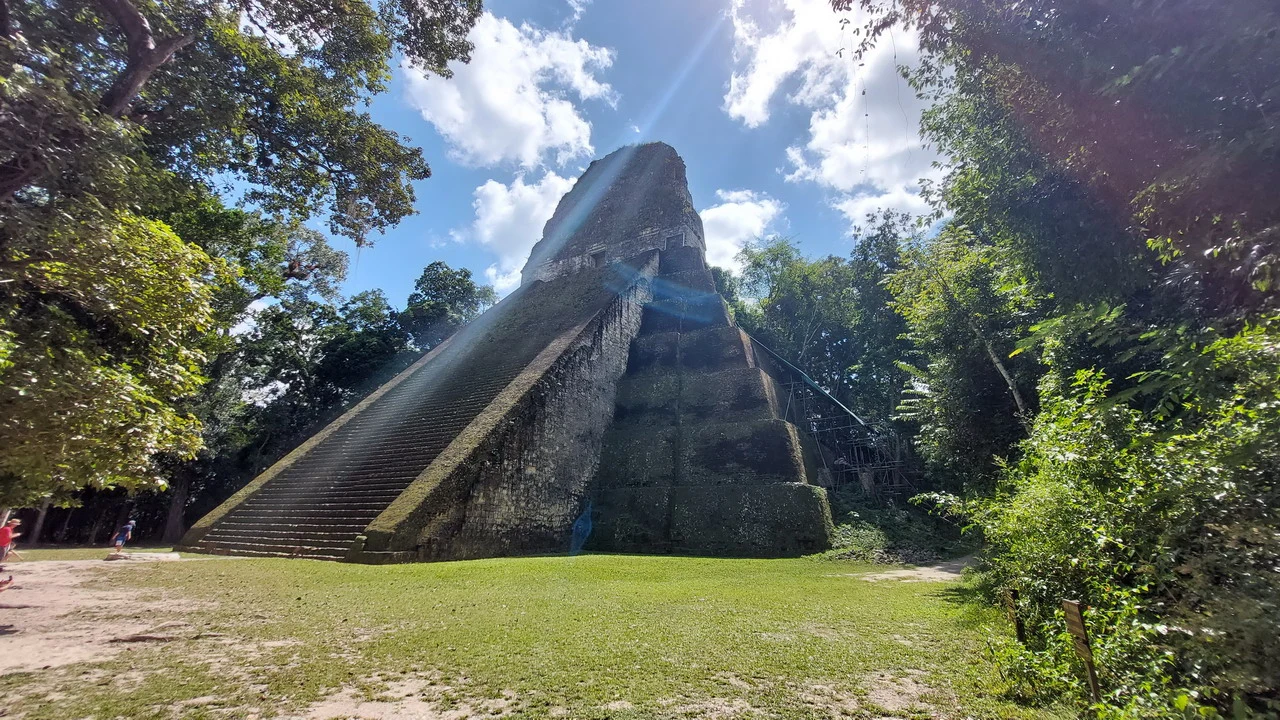
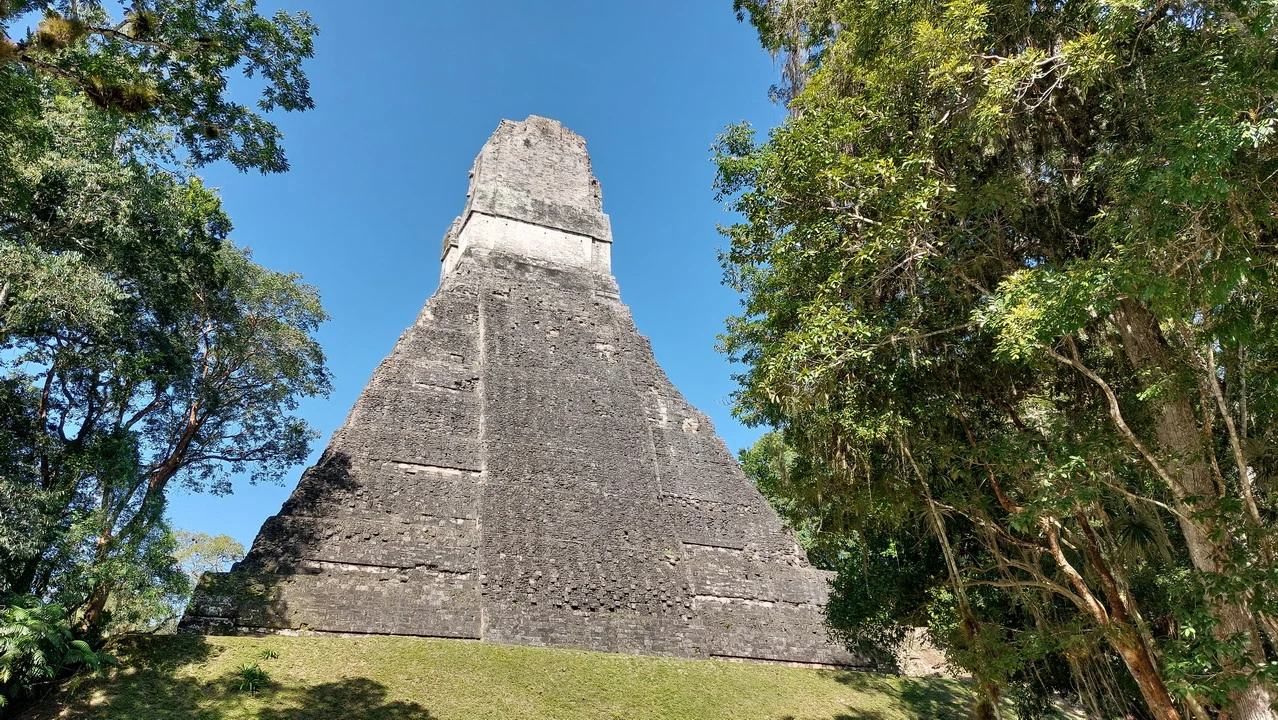
After the abandonment, the city – which during its peak period must have had around 200,000 inhabitants, including the outskirts – was covered with earth and trees due to natural events. The initial discoveries did not immediately lead to excavations; it was only when some archaeologists took the initiative that they began to uncover them. convenience However, the decision was made not to expose more than 20% of the ruins: the limestone building material would eventually crumble — as happened at Chichen Itza — and the amount of work required would be enormous. Today, a good part of the site can be visited, and it is possible to climb some pyramids via wooden stairs, enjoying… panoramic views which demonstrate how the site is still completely surrounded by dense forest. Reaching the top, you can see a green clearing from which the peak of some buildings barely stands out. This Indiana Jones-like environment adds further charm to Tikal and makes it unique in its kind, worthy of the effort of coming to this remote and distant location. In recent years, laser technology has revealed that the ruins are much more numerous than previously thought: being able to see beneath the layer of vegetation and earth that covers them, modern systems have discovered thousands of structures, which at the moment will not be subject to excavation simply to preserve them over time. The long staircases were used by the kings to reach the top of the pyramid and intercede with the gods, acting as intermediaries for the people's requests; the difficulty lay in the fact that in addition to the sacred garments, they also carried sixteen pounds of jade — more than seven kilograms — which must have made the ascent of the steep steps all the more arduous. The pyramids are filled with stone blocks and were enlarged in height and width from generation to generation; they had the temple function... approaching the sky, therefore only the king and a few others had the right to ascend. Their construction was likely carried out by thousands of slaves, who dragged the stones without yet inventing the wheel. We asked our guide for clarification on this point: both at Copán and here, we were told that the wheel was not necessary because there were no pack animals and the forest was unsuitable; instead, they moved using small boats that slid down the rivers. A response that is somewhat unsatisfactory, or at least incomplete: it seems more likely that the Maya had brilliant insights in astronomy and mathematics without actually discovering wheeled transport. Speaking of astronomy: the priests were able to predict eclipses, cleverly exploiting the temporary darkness to present them as divine wrath, with the precise purpose of gaining the people's loyalty and increasing their own power. Despite the great discoveries, unimaginable at the time in Europe, and also by the Inca, the Maya did not know the concept of zero — which appeared in Europe only in the 12th century. The slaves were always Maya prisoners of war from defeated cities. Three hours flew by literally, thanks to the fascination with Mayan history, combined with the stories and anecdotes of our guide.
Sunset and tilapia at Flores
We depart around 13:00 for Flores, where we will have the opportunity to spend some time strolling through the quiet streets of the village and witnessing a sunset that alone would be worth the trip. It's striking how the beautiful walk surrounding the island is largely overrun by lake water; we are told that this happens regularly, after heavy rains during the wet season. In this case, it was a hurricane that brought so much water in just a few days that it caused the lake level to rise; now we wait for evaporation to lower it, which could take several years. This is a significant problem for businesses located on the shore. Dinner at a restaurant – unsurprisingly – along the lake, tasting tilapia and white fish. If you plan to sleep early so that you can wake up early tomorrow, as is quite common, you will indeed wake up early.