Day 10
Caminito del Rey
The thrill of a suspended route in the void and Malga by night
Stop at Caminito del Rey
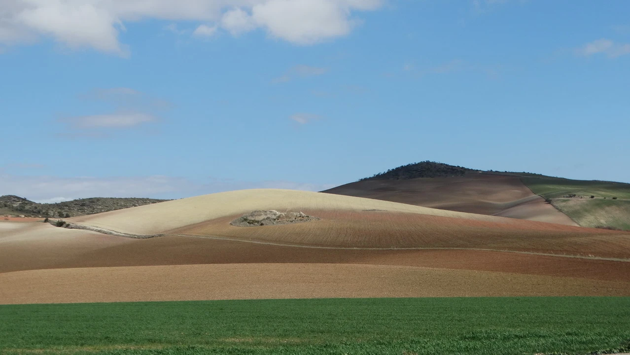
Right next to the hotel is a bar/restaurant where we were surprised to find several customers even after 7 am on Sunday morning. After trying to figure out this unusual Andalusian phenomenon, we started our journey along... rolling hills with cultivated fields Essentially, we find ourselves amidst well-maintained olive groves along the slopes and some fields of grain, heading towards the Caminito del Rey area, which we intentionally leave for last as it represents the most exciting natural attraction. Having booked our visit for 9:20 AM, we depart early and arrive after 60 km, fortunately ahead of schedule since the information on the voucher is not particularly detailed about the necessary route to reach the starting point. We park in one of the few remaining spots despite it being morning; later, a real traffic jam will form, creating congestion with cars parked everywhere along the road. We pass through the tunnel, which is a pedestrian walkway, and after a 1.5 km walk, we arrive at the meeting point. Here, we are grouped by time and taken care of by a very nice and friendly guide who provides us with all the explanations using headphones. Everything goes smoothly until her microphone malfunctions, but we are already at the end. The visit and the view are breathtaking., absolutely a must-do if you don't suffer from vertigo. Although the path has been rebuilt and opened only in 2015 with wooden railings and safety barriers, walking along the middle of the cliff face is an amazing experience. steep canyon It's still an amazing experience, especially when you get to see where we stayed and where we will need to pass. Everything started with the construction of a hydroelectric power plant at the beginning of the last century, and the suspended walkway was used by service personnel. Once abandoned, in the 1960s it became a thrill-seeking trail, and there were several fatal accidents. It was then closed and renovated to be used for tourism purposes, which was a particularly clever idea since full occupancy is the norm, especially on weekends and during peak seasons. We will cover over three kilometers this way and exit on the other side, into the chain of three canyons. A bus will take us back to the entrance, and from there we will continue by car in search of a lunch spot.
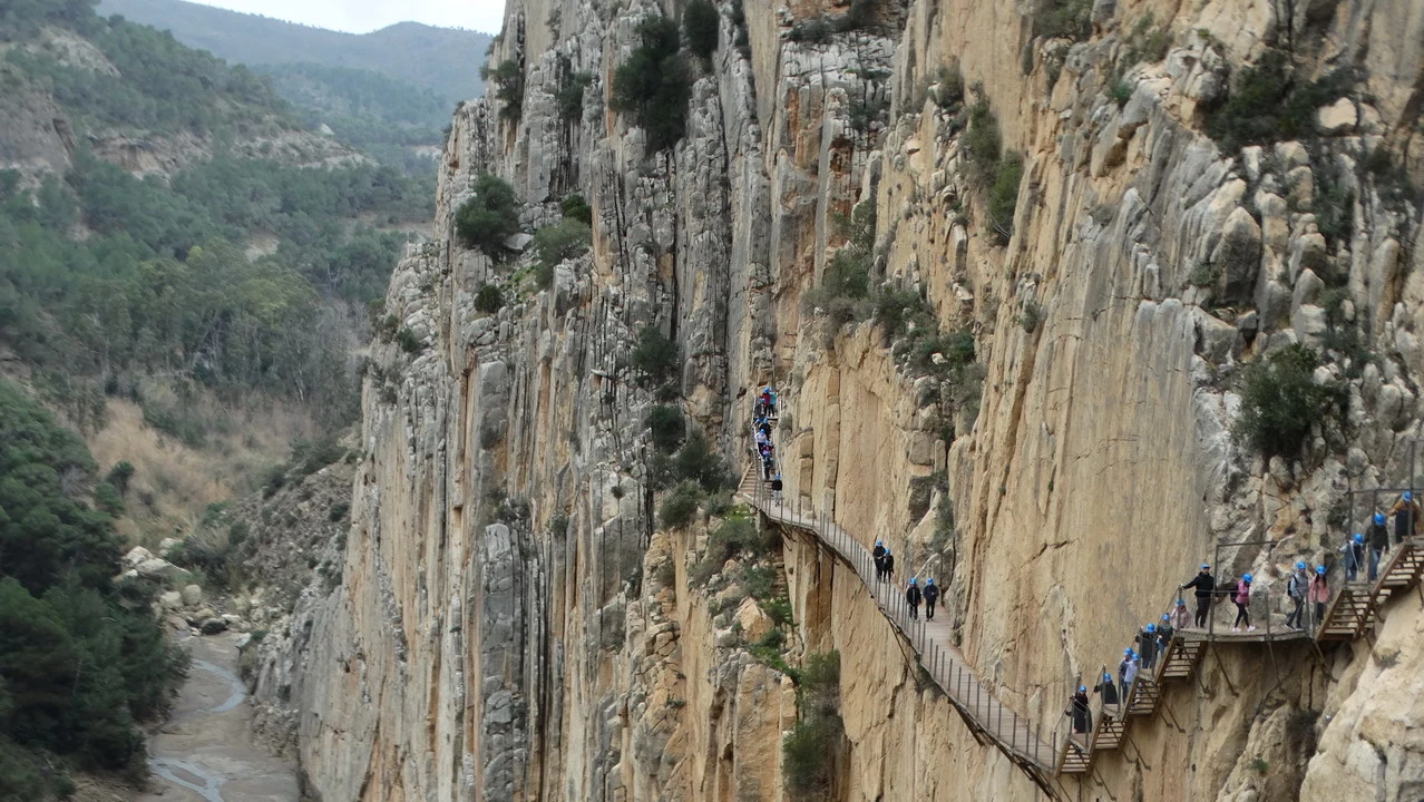
The guide provides some interesting information, such as the reason for the very green and murky water color: it is a combination of microscopic algae suspended in saltiness and the refraction of sunlight. We also learn that the engineer who designed the dam for the hydroelectric project was not originally from the area: thanks to the success of the idea and the energy obtained at competitive costs, he was then able to buy the other two electricity production companies in the area, which were owned by English and German companies, and which used coal to produce steam but were unable to guarantee a constant service. The narrative suggests that there were no particular incidents on site despite the extremely exposed tracks, only one victim crushed by a load and another due to climatic reasons, which is absolutely not credible. All the workers were sailors mainly from Málaga and surrounding areas. It is undeniable that these were extremely dangerous jobs with the limited protection available at the time; it is enough to think that only in recent decades (from 1975 to 2003, the date of closure and complete prohibition of access) when the place became a playground for people seeking risk, there were 14 fatal incidents. Three young people died simultaneously while doing a zipline together to cross the canyon and reach the climbing gyms on the other side; the anchor failed and they fell; the rope is still hanging as a warning. An abandoned house in the heart of the route tells the story of Don Miguel, his wife and their 11 children, who walked for a total of 8 km along the dangerous suspended sidewalks to go to school and return. The man died during the period when the engineer bought the property: the widow remained alone with her children and managed to prepare lunches for the workers working on the construction site and the children made trips to what is remembered as the first takeaway in Spanish history. There are also wild goats and one of the largest Spanish colonies of vultures, which we can see flying high in the sky, almost waiting for someone to jump down. The railway that passes through tunnels and cliffs on the other side is still active and a scene from a film starring Frank Sinatra was filmed on the green bridge in front of us. The rock in the three canyons is partly limestone and partly clay, a formation that retains heat, reaching up to 43°C in summer, while in winter the environment can also be very cold due to wind currents. Among the trees there are eucalyptus from Australia and pines, which have the great advantage of forming an intertwined root system on the surface, useful for preventing landslides. Finally, it is interesting to know about the surname Heredero:
Many of the workers (including some Roma) did not even have a surname at the time. One of the managers decided to authorize them to use their own surnames so that people could register and appear officially with documents that allowed them to appear legally before the state. This is why there are many "Heredero" families in the area without any family or kinship ties between them.
Arrival at Caminito del Rey
Finally, a note about the name of the route: although it is called "Caminito del Rey," in reality, the king had an unintentionally marginal role. Invited for the inauguration and unfortunately encountering unfavorable weather conditions, he only walked a short section of the path and was picked up the following day to avoid further problems.
Lunch at Ardales with fried squid and cod, in a beautiful village that slopes downwards from the top where the church is located, with very steep streets. The day started beautifully, with pleasant ventilation.
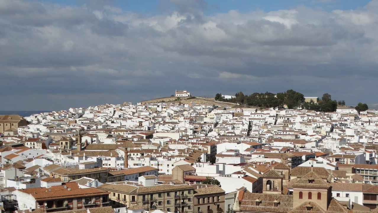
Along the next stretch that leads to Antequera, we travel through soft hills where the hotel and airline names stand out as always the olive groves, many of which had been recently planted, and fields of grain. Upon arriving in the city, we took advantage of the parking available in the center to go up to the top floor and enjoy a first overview, so we see the Alcazaba, strategically located at the top of the hill and with great views.
Stop at Muelle Uno
A toll road (the first one encountered in Andalusia) quickly takes us to Málaga, a distance of 60 km, arriving before dusk with reasonable Sunday evening traffic. Check-in at the hotel booked in an area close to the center, planning a visit to the city and setting off to explore this charming corner of Spain. What was once a deserted and rarely used port area has become a covered walkway leading to the lighthouse, named "the". Pier One Couples and families enjoy the combination of natural light with the early morning illumination of the monuments. As if we hadn't walked enough, we take a stroll around the area in front of the sea, enjoying the beautiful lighting of... Bullring, the town hall, The Alcazaba, the Roman Theatre and the city center. Dinner with grilled seafood and then return. The impression is that of a city that, while not having the same historical and cultural attractions as Granada, Cordoba, and Seville (although it has plenty), has focused on human-sized modernization to attract visitors. A definitely successful choice, thanks also to its location which offers an extremely pleasant view of the sea.