

Day 7
Newfoundland II
Up to St. John's, where Canada starts. Night departure from Argentia and 13 hours on a ferry to Nova Scotia.
Towards Newfoundland
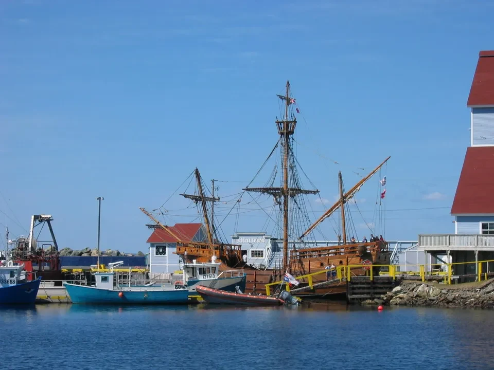
We depart at 8:10 from Gander after a very satisfying breakfast (filled crepes with berries, toast with blueberries, etc.) and under clear skies. As soon as we enter the Terranova National Park, a sign warns us to be careful around moose, indicating that there have been 7 incidents in this area this year. Continuing along the Bonavista Peninsula, we arrive at the same-named head and let's see the Matthew, a copy of the ship used by Cabot during his voyage.
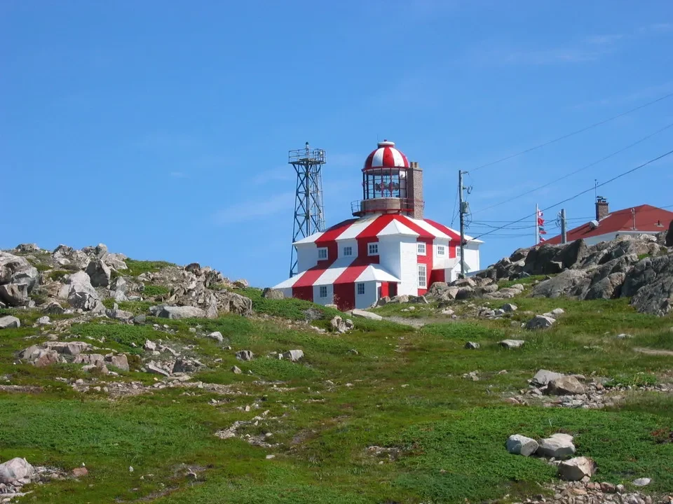
In fact, just a few kilometers away is the location where the Venetian navigator working for the English crown docked in 1497. At the location There is a statue of him. a white and red striped lighthouse, of remarkable size. It was indeed the first Western (excluding the Vikings 500 years earlier) to land on the Canadian coast, and for this reason it enjoys greater fame here than in its native country. The head is exceptionally scenic, with several coves and water that seems like the Caribbean, except for the decidedly colder temperature. The nearby rock formations are teeming with birds. Talking to a gas station attendant, we learn that it hasn't rained heavily in the region since mid-June, and this is confirmed by the now yellowed grass.
The urban face of Newfoundland
We descend through Clarenville and reach St. John's (the capital of Newfoundland) in the afternoon. It is a port city with a population of around 170,000 people. The suburbs are somewhat run-down, but we head up to... Signal Hill where is the Cabot Tower located? From this point, you have a wonderful overview of the port and the Narrows, the narrow passages that connect the port with open sea. This is a bay that nature has perfectly shaped. To reach it, we left the car at the visitor center and then walked to the Queen's Battery, which is located above the Narrows. In the city center, we can see the starting point of... Trans Canada Highway, namely the 0 km. From here, almost 8000 km of road lead along the coast of the Pacific in British Columbia. This road is kept open regardless of weather conditions, at a considerable cost. We visit... Cape Spear, where the vegetation, despite the current calm, makes us think that a fresh, strong and frequent wind blows on this promontory, which represents the easternmost point of North America. From here we are closer to the Irish coast than to the western border of Ontario (Thunder Bay). There are still 4500 km of ocean. We see the guard posts dating back to World War II, set up to watch out for German submarines: they were never used. At 6:15 PM we depart for Argentia. We have dinner in Placentia as usual, with fish as the main course, at one of the best restaurants in the Canadian territory. With everything arranged, we head towards Argentia, from whose port we will set sail at 11:59 PM in direction North Sidney (NS). The motorboat is called Mr. Joseph & Clara Smallwood.
We take the car to the second floor of the Ferry (below are the campers and trucks) and reach the seventh floor, where we find the day-nighters that we had booked in a climate-controlled room. These are two reclining seats where we can sleep for the entire night. It's not like our own bed at home, but it's already more comfortable than an airplane seat.


