

Day 4
Extreme southwest
Rocky peninsulas where the ocean relentlessly attacks the land.
Morning at the Drombeg Stone Circle
The usual breakfast on the way and we head towards the southern coast where Kinsale is located, a Breton fortress situated in a strategic yet sheltered position. The weather doesn't always have to be perfect, according to... vibrant building colors, almost as if the friendly locals are trying to fight against the monotony imposed from above in this way. A walk is definitely worthwhile, just as is the wonderful view from the top of the Charles Fort Despite a rather uncomfortable breeze. However, the biggest challenge is represented by the narrow road leading to the promontory, where encountering another vehicle means measuring every centimetre to avoid the civil but nonetheless present drivers. The road leads us inland to quickly visit Skibbereen and some nearby villages close to the coast, where life flows slowly like the waves crashing against the rocks.
Drombeg Stone Circle and Mizen Head
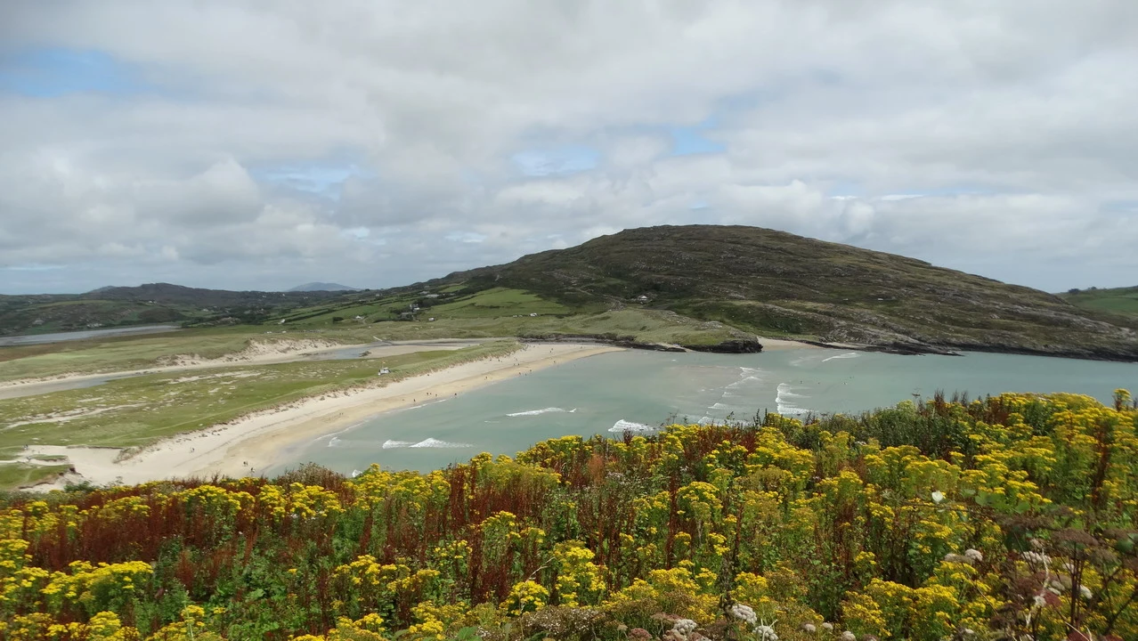
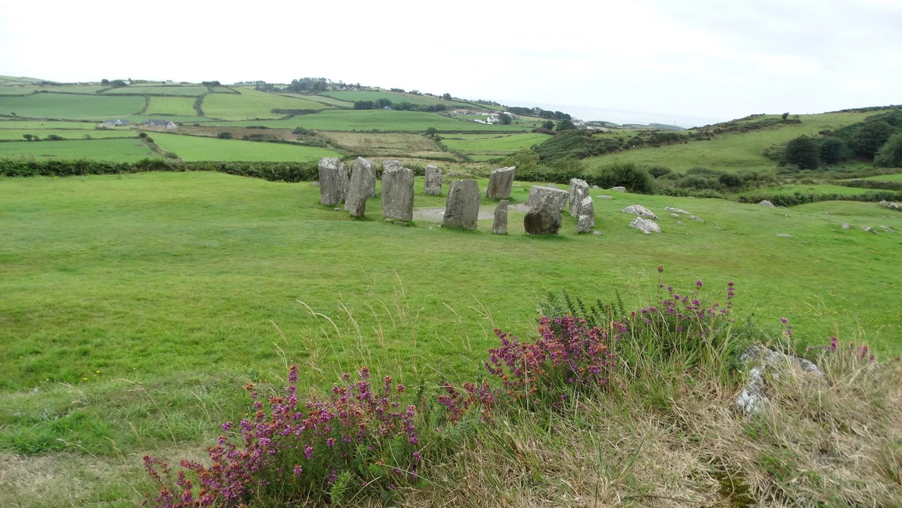
From this point on, the landscape consists of coves that extend inland to form a series of distinct peninsulas, while the ground is a gently sloping, green terrain of hills that slowly descend towards the blue sea; here you can find several farms whose main activity is livestock farming, dotted with cows and sheep grazing in the lush pastures bordered by picturesque stone walls. A very different environment compared to the rocky cliffs of the western coast, but less dramatic, yet more relaxed and contemplative. In contrast, agriculture seems absent from the Irish countryside; we have seen some fields occasionally, but it certainly shouldn't be a national pride. We cross a large part of the south-west of the country along a road that sometimes overlooks the sea, stopping at the site of Drombeg Stone Circle... with 17 menhirs arranged in a circle for some propitiatory ritual dating back to the dawn of the Christian era, at a time when it was not yet landed in these desolate lands. The menhirs arranged in a circle are surrounded by a vast expanse of red heather in full bloom. A place where one could cook is also notable on the site, indicating that, given the relative stability of temperatures, this was likely a place where one could stay for a long time. Exploring the southernmost peninsula leads us to Mizen Head, where the grey sky barely manages to soften the majesty of a landscape represented by the dramatic cliff overlooking the sea. The roughness of the waves crashing against the rocks contrasts with the plateau above, where some horses graze peacefully. We believe that the view is worth seeing without paying for the ticket to visit the actual headland, which is connected to the mainland by a metal footbridge. As we return – as if we were in a theatre – a beam of sunlight illuminates the small beach of Crookhaven, creating colors that are simply amazing.
Excursion to the Beara Peninsula
After Bantry, we head further into the Beara Peninsula until the fork that leads to the Healy Pass... before crossing it, we stop for a scenic walk with the wind gently caressing us, but the view on both sides is magical, accompanied at times by the usual sunbeams that tend to illuminate details of the valleys below along which the road winds, in a profusion of heather and other flowers. We descend onto the northern side and our attention is drawn to the sudden change in vegetation as the altitude decreases, even though we started from just 334 meters above sea level on the hilltop, passing from fields rich in heather to the area dominated by bushes and low trees, ending along the coast with almost tropical-style tall vegetation. This vegetation at lower altitudes must be due to the short but intense and fine rains that combine well with temperatures that are not hot but constant throughout the year. The vegetation is also favored by the mild Gulf Current, which takes on incredible tropical characteristics, dotted with palm trees, bamboo, and agave plants. We continue for a few more kilometers in the easterly direction, but this time the forest almost completely prevents us from seeing the sea, so we return towards Kenmare.
Kerry County
County of Kerry
The urban face of Drombeg Stone Circle
a beautiful town overrun with tourists. The time is really tight today, we can't make it around the Ring of Kerry and we are crossing the mountain range passing through the Moll's Gap from which we expected more interesting scenic attractions, but still worth a few photos. We descend and cross the Killarney National Park, then the eponymous town during the afternoon, among a significant representation of Irish bourgeoisie, arriving in Killorglin, where we will have a good dinner at a pub, enjoying local cuisine accompanied by the now familiar Guinness. From the bottom of the Beara Peninsula and along the Dingle Peninsula The signs were written in English, French, and German, while various shops had double signage in English and French.
It's time to continue the short drive towards Anascaul, where a friendly host of a previously booked B&B is waiting for us. In the meantime, we have the opportunity to admire the setting sun filtering through a layer of light clouds, projecting surreal images onto the waters of the fjord. After quickly settling into our room, we still find time for a beer (from the same brand) and an Irish Coffee in a typical pub a short walk from our accommodation; we were able to enjoy meals outdoors, mingling with the local residents and even feeling like we were in Gaelic-speaking Ireland for a moment, no doubt helped by the dark drink. It is nevertheless interesting to note how, in a village of barely 300 inhabitants, there are three pubs, all decorated in a completely typical style, with photos on the walls and strings of light bulbs that barely illuminate the premises, giving it a warm and welcoming atmosphere.
The day's results are positive in terms of the locations visited, with the impressive sight of the mainland stretching for dozens of kilometers into the sea, or vice versa, but it has a less interesting morphology while the Dingle area is definitely more attractive, due to its greater resemblance to a fjord.


