Day 6
Cliffs of Moher and Galway
Cliffs of Moher: The day to play your last card with the sun – Galway: beautiful university city
The urban face of Galway
Limerick is one of those cities that seems to have an intrinsic, nostalgic sadness, from the main monuments to the houses. Walking its central streets gives the feeling of being in a rundown suburb. Few people around, homes reduced to the essentials, and the sky adding to the atmosphere. Perhaps it was just a series of coincidences that presented us with this gloomy picture, but there is life in the city and a sense of social connection. However, arriving anonymously on a weekday morning with a cloudy sky doesn't allow you to expect to be greeted with festive attire. The most interesting building is King's John Castle, on the banks of the River Shannon, an imposing building built in the early 1200s for defense and therefore not particularly elegant architecturally. Dominating the river course, guarding the waterway with two impressive cylindrical towers and typical features of a manor designed to keep enemies at bay. It is surprising how little water flows in the river, but we will see it so impressively upstream, in Athlone. Also the St. Mary's Cathedral It is of great interest, with its imposing appearance both inside and out. Leaving the center, we come across the legendary rugby stadium, a venue for epic sporting battles. Given the overcast sky, the temperature range between minimum and maximum does not vary much, ranging from 14 to 18°C. The numerous and beautiful flower beds scattered on the bridge and along the main streets of the city help to contrast with the overall grayness.
The Bunratty castle is definitely a popular attraction, given the large parking area and the crowds heading towards the entrance.
From the outside, you can see very little, and we think it's best not to go in to play our trump card, the Cliffs of Moher.
Clare County
CLARE COUNTY
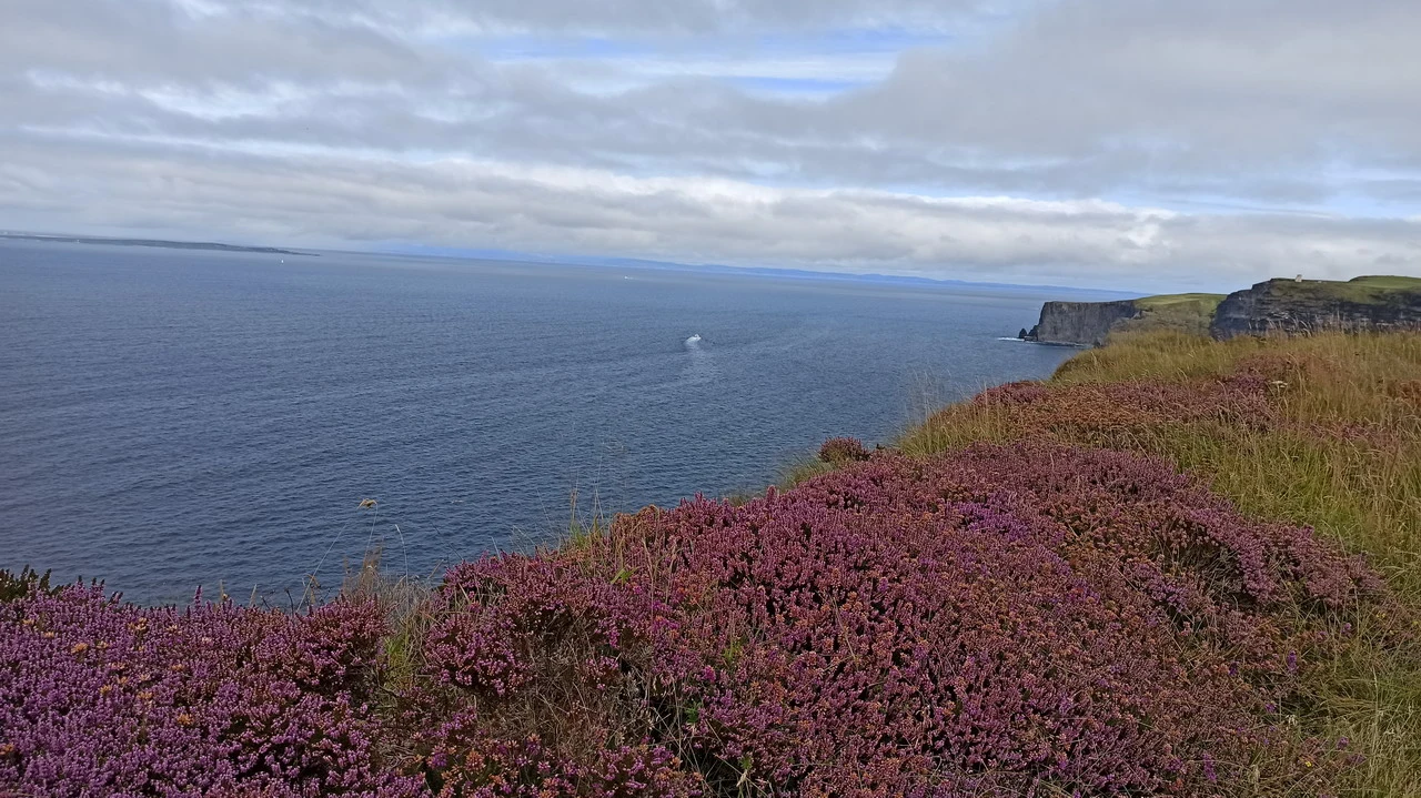
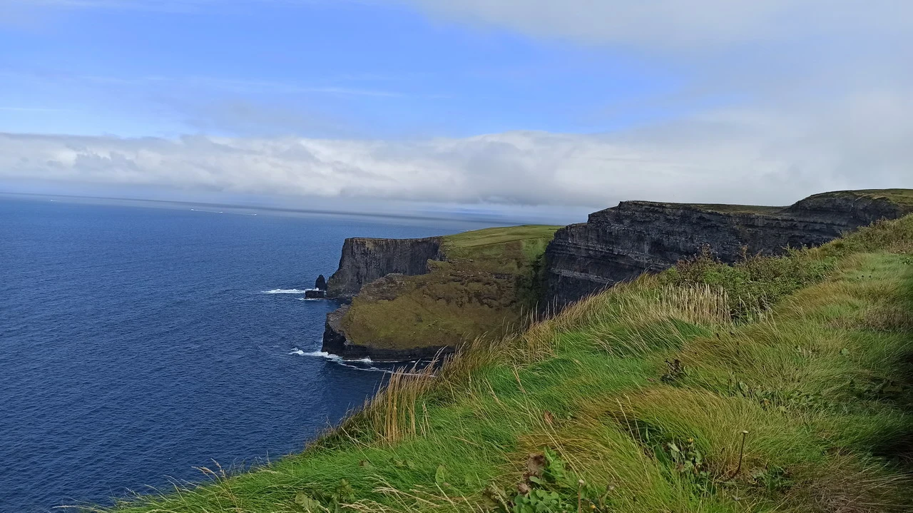
We pass through some lovely fishing villages, knowing full well that what awaits us is nothing but grey. When we reach them, the fog barely allows us to see in front of the car. We decide to spend or throw away (depending on opinions) €10 each for parking, which also includes entry to the natural monument. With little hope for the immediate future, we go to see the beautiful Visitor Center, built integrating the building under a soft hill, with zero impact on the surrounding nature. We take it easy and believe that the visit is already complete, as the Cliffs can only be seen with great imagination. When we leave, it seems like a miracle has happened: the fog has disappeared, leaving only some clouds, but by Aran Islands We can see vast, tranquil spaces, an archipelago where Irish history unfolded and that remains steeped in authentic Gaelic culture. We approach with eager anticipation, searching for... breathtaking views which are not lacking, well aware that the curtain could close at any moment. Instead, it opens further, revealing a dazzling display of blue and green. We walk along the path northwards, bordered by large stone slabs, passing through some barriers that would prevent entry but which everyone ignores, to reach a promontory from which we have a wonderful view of steep cliffs over 200 meters. The Irish sky offers its best at certain times: looking from one side, it seems that The heavy rain is about to start., on the other hand, it seems possible to see paradise It was a gift we hadn't expected, and therefore even more appreciated. Returning to the base, we follow the southern trail for another few kilometers, never tiring of walking and seeing, always careful on certain sections where it dangerously borders the cliff edge. Yellow flowers and lush greenery They add another touch, as if it weren't already enough; on the inner side, groups of cattle graze peacefully on the plateau, in stark contrast with the rugged beauty of the cliffs. We return to the Visitors Centre area, where there is even a Meditation Center nearby. Arriving at 11 and departing at 3 pm, we think this will be sufficient. Returning to the parking lot, we open our suitcase which contains a perfectly preserved smoked salmon slice, thanks to the mild temperatures, and finish it in no time. In addition, we also discover that this area is the birthplace of traditional Irish music, thanks to shepherds looking for entertainment during long periods of bad weather and a particular wood useful for building flutes, which were then used everywhere for the music that the country is known for. From here, tourism to the Cliffs began: it all started thanks to a person from a nearby village who started taking people to see the cliffs, listening to music with them. From there, one can say that the place's tourist vocation was born, which has now become a real and quiet business. Heading towards Galway, we cross Burren, lunar landscape with karst terrain, what could be described as a stone desert, a surface similar to concrete but for some roughness and deep, narrow fissures. Obviously, the grayish surface is not suitable for any cultivation, and grazing is almost non-existent. After this natural cementation, we continue along a beautiful coastal road that runs alongside Black Head, a headland exposed to the Atlantic winds, with a scenic lighthouse from another era, white in color, perfectly contrasting with the blue of the Atlantic and the green of the inland. We continue towards Galway.
Galway County
GALWAY COUNTY
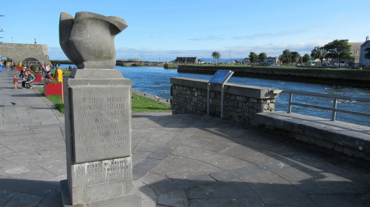
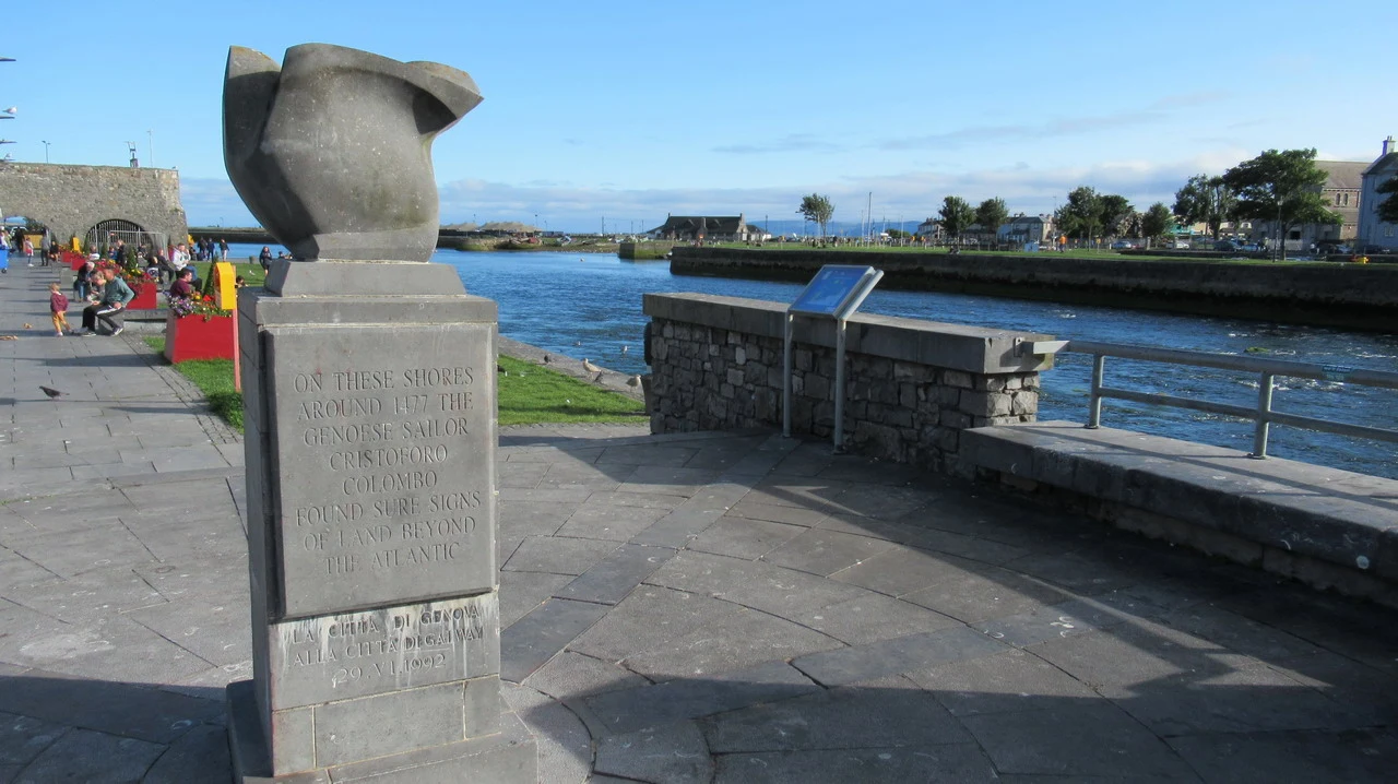
a coastal city, with picturesque harbors and colorful houses. The city was chosen to be the European Capital of Culture in 2020, overlooking the Atlantic Ocean. It is a bit chaotic but more pleasant than other cities due to its graceful architecture and the vibrant atmosphere created by the large university community. Wonderful... Cathedral Dating back to 1965 and with an engaging story, the building's construction is iconic, having been built on the site of a former prison. It is located slightly outside the center, but is well connected by paths along the river, particularly to the Spanish Arch, from which the beautiful, sun-drenched estuary of opens. River Corrib... where the salmon fishermen are trying to get dinner. We discover at this point a piece of unknown history, reading the inscription on the monument which reminds us that these shores were once... the Genoese navigator Christopher Columbus found clear evidence of land on the other side of the Atlantic. A fascinating detail that would be worth exploring further in a biography of our fellow countryman. The rest of the center is a maze of beautiful streets where young people and tourists gather for a drink before dinner. Perhaps it lacks some hygiene, but the atmosphere is very lively.
We take the N59 north to reach Oughterard, where we stay overnight in a room. View of Lough Corrib The house is secluded and the silence is complete. Reaching it would also have been difficult without GPS references. We go for dinner in town, where the restaurant we are interested in has free tables only later, we do our grocery shopping for the next day and finally enjoy a plate of haddock and halibut. I decide to follow a Connemara beer (good with a rose aftertaste) to the usual Guinness, but when you're used to it, changing is always a negative experience. The cider, excellent, is from Boulders. It surprises us how in a seemingly insignificant place like Oughterard, there are so many tourists, including Italians and many children, but especially visitors who stay for several days.