

Day 2
French Pyrenees
The Tour de France route at Col du Tourmalet, natural spirituality in Gavarnie and religious spirituality in Lourdes.
Bagneres-de-Luchon and Superbagneres
Breakfast while the other guests are just waking up and then heading out shortly before 8 am towards the bottom, passing through Saint-Beat, which is known for its marble from local quarries and... the sculptures that various artists have recorded for them. The country seems to be exactly as it was fifty years ago, it's not particularly beautiful, but precisely because of this, it has a unique character.
At Chaum, we take the N125 towards... Bagneres-de-Luchon It feels like stepping back in time and seeing the ladies with their parasols and the gentlemen in top hats strolling along the Allee d'Etigny. Actually, it's still early as no one is yet dedicated to a leisurely walk, but this ancient thermal resort still retains traces of a bygone era. Now, it mainly thrives on winter tourism, but the building itself remains unchanged. In these valleys, we encounter many dams or forced conduits that utilize hydroelectric power.
Peyresourde, Aspin and Tourmalet
With twenty kilometers of steep ascent through a narrow valley, we arrive at Superbagneres, at an altitude of 1804 meters. It is a flat plateau with Fairmont-style hotel, where the cable car arrives from Bagneres-de-Luchon and others depart in various directions. The the view is truly of those worth climbing to, you can even see the Pico de Aneto with the group of Maladeta and the glaciers at their base. At 9:30, it's already 22 degrees Celsius and there is no wind.
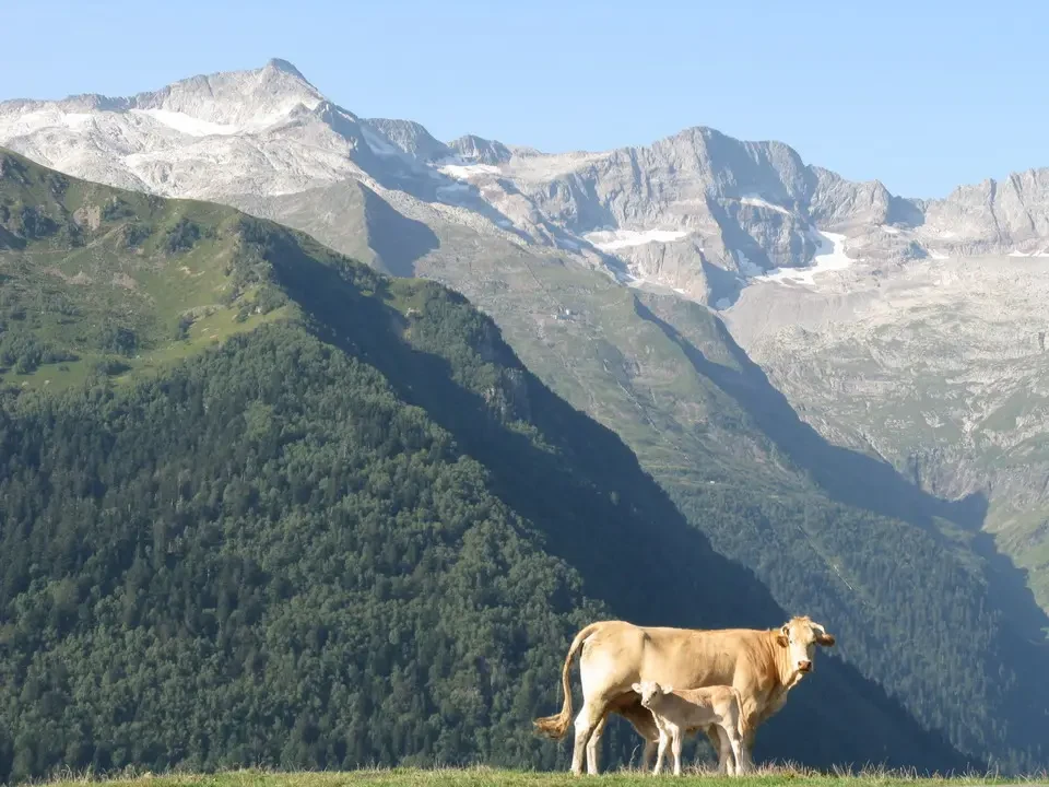
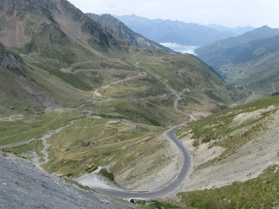
At a shop in Bagneres, we buy some Pyrenees ham for lunch and continue on to the second part of our day's climb: the Col de Peyresourde, altitude 1569, which brings us to Arreau, located exactly at the same distance between the Mediterranean and the Atlantic. It is a very green area, likely due to frequent rainfall. Many coniferous trees accompanied by abundant deciduous forests, even at altitudes where we normally find them. Another characteristic are the slate roofs, either in tiles or shingles. The villages seen from above are dark spots that well integrate into the surrounding landscape. So far, the towns appear well-maintained and there is generally no sense of abandonment due to emigration, which has affected our valleys. With a difference of about 700 meters, we reach the Col d'Aspin at 1489 meters in a green and coniferous landscape, even in the lower part. We descend below the cloud level to rise above and pierce through them. un exceptional situation: a fjord of clouds opens beneath us, while the valleys return to their vibrant green under a bright sun. We begin the ascent to the legendary Col du Tourmalet, at an altitude of 2115 meters, with a climb with a height of 1300 meters over 13 kilometers. On the roads of the classic cycling climbs, signs are placed indicating the distance to each pass, the percentage of slope and altitude. It is the highest paved road in the Pyrenees and is a classic of the Tour de France, but also for all cyclists who want to challenge their limits. A cool breeze blows while some South American animals... alpaca?, quietly smoldering just a few meters below the hill.
Gavarnie and evening in Lourdes
Shortly after, we passed through the rundown village of La Mongie, a renowned winter sports center. Not only did the inevitable chaos that arises from building cities for skiing, but the French architects also offended the mountain with constructions that do not integrate at all into the local landscape. Close to the pass is Pic du Midi, which shares both its name and structures with the more famous Aiguille du Midi. The strong winds and clouds convince us to abandon the temptation of reaching Pic. Passing through Gedre, in the direction of Gavarnie, we see the hotel Breche de Roland, from which we have a great view of mythological and namesake crack, 80 meters high and 50 meters wide, located to the left of the Gavarnie circus, which legend says was created by Orlando Furioso after Charles the Great did not send reinforcements during the war against the Moors. In his anger, he created this gap with a blow from his sword.
The village of Gavarnie, in the National Park of the Pyrenees, is the heart of the French Pyrenees, also thanks to its proximity to Lourdes, but it deserves a visit on its own. The large paid parking lot represents the most likely source of income, but the town is orderly and pleasant. From here starts the path that slowly climbs towards the eponymous glacial cirque, arriving at the base in one hour and fifteen minutes. wonderful Great Falls, high 422 meters We first arrive at the Hotel du Cirque et de la Cascade, where all those who have arrived on horseback or mule are staying, and then we tackle the final stretch along a slippery stone path to the beautiful waterfall. The sky remains clear with expansive clouds, although the temperature is warm. Together with those located on the southern side of Ordesa National Park, there are five glacial or amphitheater-like valleys that descend steeply towards the valley floor, while at higher elevations, gentler slopes open up.
As we descend, the sky becomes increasingly overcast. A constant feature of the vegetation in the Pyrenees is the rowan tree. The forests are full of these trees, easily recognizable by their red berries. Alongside the roads, you can find many birch trees.
We arrive in Lourdes shortly after 6 pm and find accommodation at the Hotel Ocean. Dinner is at 7 pm, and then we go... at the Esplanade towards the sanctuary where the procession takes place at 9 pm. The low clouds bring down a light rain that becomes increasingly persistent, until it stops just before the procession ends. Very touching was the crowd of... devotees with candles In hand, preceded by those who are forced to use wheelchairs, the shops selling all kinds of religious trinkets are much less problematic; this includes empty bottles of 5 or 10 liters for filling with holy water. A Polish choral group is gathered in the basilica's courtyard, and we stop to listen to them, completely captivated. We then take a tour of the underground church of St. Pius X, which can accommodate 200,000 people. It is not aesthetically pleasing but useful during persistent rain. We return when it is already midnight.


