

Day 10
Torres del Paine I
Exciting trip under the Cuernos del Paine in the Valley of France.
Paine
Torres del Paine National Park (Chile)
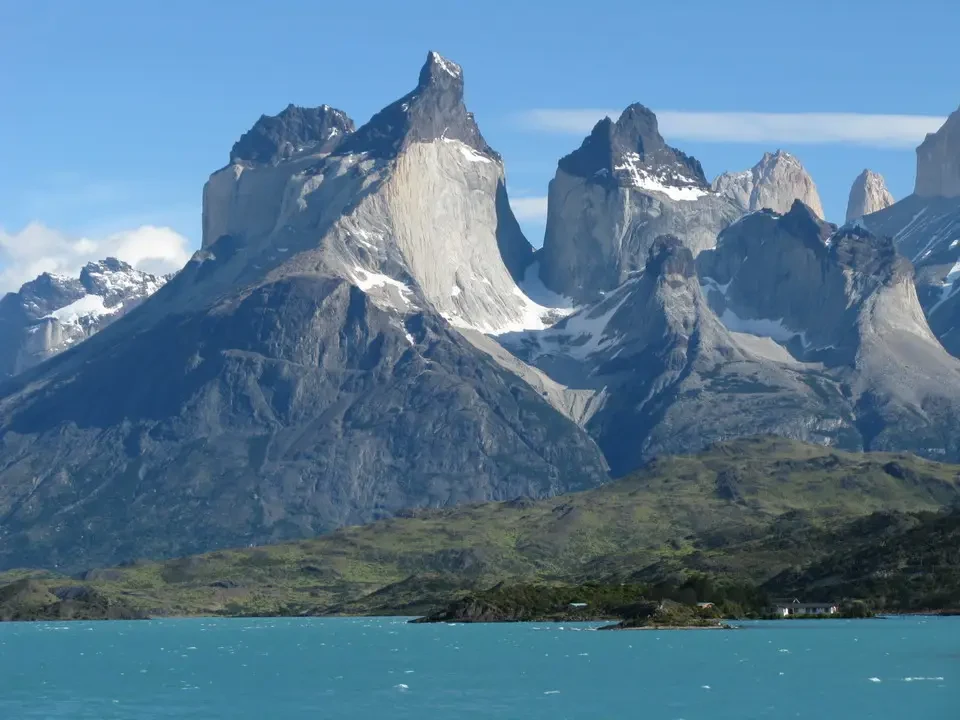
We are sailing on Lake Pehoé and Cuernos del Paine.
Over many years of exploring the Alps and beyond, I had never started a trip with a 40-minute ferry ride to reach the beginning of the trail. This is what happened on the first day of our two-day trip to... Parque del Paine Okay, let's go step by step: keeping in mind that the ferry departs at 9:30 and won't wait for us, we aim to have breakfast as early as possible, so we are ready to leave at 6:45. Along the way, we encounter fields of lupins and gorse (the vegetation that will characterize the entire area), while numerous foxes cross the road in the early morning. We also need to check in and purchase a three-day pass for the park. We would be perfectly on time if it weren't for the fact that during the journey to the southern entrance of the park (Guarderia Serrano, where we buy the entry pass), we encounter some sights that require us to stop and admire, and therefore also take photos. Although we are not completely captivated by all this beauty, time passes quickly, and we arrive at Pudeto to board a boat packed with an unbelievable number of hikers from all walks of life and backgrounds. We are sailing on Lake Pehoé., with such intense turquoise colors that they seem solid, at the foot of the Cuernos del Paine and its neighbors. Shortly after departure, there is the Grande Jump, a waterfall that connects two lakes and represents one of the attractions. We stay on the catamaran bridge, buffeted by strong winds that do not diminish our resistance in front of an unparalleled work of art. Something that an artist could only have copied in a pedestrian way. The sky provides a contrast to the lake colors ... or vice versa. In between, massive mountains raise their peaks to the top of steep walls. The color of the water is also called "glacial milk". This is due to the fine sand particles suspended in it, which allow all colors to filter through except blue, which is therefore reflected. It's similar to what happens with the color of ice: the more compressed it is, the more pronounced the blue tone becomes.
The two-tone rock formations It originates from the cooled magma at the base, giving rise to granite. The upper dark part is instead due to the sedimentation of volcanic dust that reached a thickness of several hundred meters. The glaciers then did the rest, creating walls over 1000 meters high.
Arrival at Paine
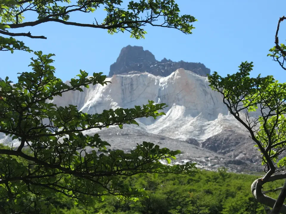
Once we arrive, another countdown begins. Today, our goal is to reach a viewpoint located in the Valley of Frances (also part of the W route), and we need to be back for the 18:30 ferry. Arriving any further would mean spending the night on site and ruining plans for the following day. Checking the time, we calculate the intermediate times, knowing that we won't be able to make up lost time on the return journey, as it involves a lot of ups and downs. Starting from Los Cuernos refuge in one hour and 40 minutes, we reach the Italian Camp, located within a ñire forest, thus embarking on the French Valley ...and then we went inside to the British Camp (which also took about the same time), located higher up but with a relatively gentle slope. The final stretch finally presents a good climb to reach a beautiful viewpoint in the center of the valley, from which you can enjoy a wonderful view. a wonderful view. Actually, we go a bit further up towards... Hornes in another hour. Across from us is the group of Cerro Paine Grande with its impressive glaciers. The return trip was quick but also long, and sometimes monotonous due to fatigue that began to set in, not really because of the scenery. We arrived half an hour before the catamaran departure time, which was our planned time, just to avoid any risks. In total, we covered at least 900 meters of elevation gain on a day where we enjoyed constant sunshine and unforgettable views. As on the way there, the return trip requires about two hours by car on a dirt road, and arrival in Puerto Natales is not before 9:30 PM. We celebrate this wonderful and long day with a large crab with mayonnaise and grilled salmon at the restaurant La Barbuja.


