Day 2
Valletta and historical sites
The history of the island
Stop at Manoel Island
At 7:15 am, we were ready to begin our adventure. In fact, we would have been ready for breakfast, but a helpful Corto (of short stature) Maltese who was stationed in the restaurant hall informed us that to eat at the agreed price of 7 Euros, one must be a loyal customer and commit to staying for all three days. This didn't seem like a good deal, as the morning has its own charm, and we certainly couldn't wait around like many tourists do. We therefore removed ourselves from the situation and had breakfast at a kiosk along the coastal road leading to the northern side of the island. The sky was typically springtime-like, with clouds moving about creating scenes sometimes similar to those in an Irish summer. Luckily, there wasn't even a hint of rain. This is perfect for taking photos when the beams of sunlight illuminate a rock formation, a village or a tower located on a promontory, but one must be quick to capture the magical moment. Along the fast-moving roads, we reached the area of Sliema, while the island starts to come alive. The tourist complexes stand out, and there seems to be a lack of space. It's surprising how quickly things pick up after crossing the bridge that leads to... Manoel Island We find ourselves in a deserted area, even neglected despite being located in the center. The fort was abandoned during renovations, and rusty scaffolding structures seem to support it in its centuries-old state. Strange Maltese things, a land where contrasts don't stop at this island within an island.


The urban face of Valletta
Right across from us are the buildings of Valletta, the small but charming capital of this small state. Here too, we can see the contrasts (this time stylistic) between the... narrow alleyways that follow the contours of the terrain and the entrance structures to the historic center designed by Renzo Piano: City Gate, Parliament Building and the Opera House. The latter was deliberately left with its columns damaged by the bombings of World War II, and an open-air theatre was created inside. It's definitely a unique reminder: saying it's beautiful is impossible, but what could it be when you want to recall a terrible event? Instead, the viewpoint that rises above the ramparts erected at right angles over the ditches that defended the city. Inside, an orderly network of perpendicular streets winds, from which decorated structures protrude. balconies with a covered area and where can you find the wonders of the capital: from Church of St. Paul's Shipwreck al Grand Master's Palace, where we visit the luxurious interiors, and the


St. John's Co-Cathedral, a true gem nestled in the city center, with... Caravaggio's works that I spent periods of varying fortunes here. It's now lunchtime and it's natural to try the pastizzi, small pastries filled with ricotta and other ingredients. We wouldn't have come here specifically for them, but they are a worthwhile snack. The Fort of St. Elmo Mark the point where the Valletta peninsula ends and you need to return, following along the southern side with wonderful view of Vittoriosa and the other two sites that contribute to forming the Three Cities. At this point, all that remains is to complete the tour by visiting the Upper Barrakka Gardens with their wonderful view that allow to be framed by arches built with the typical yellowish limestone. The cannons The following are no longer aimed at enemies but for firing volleys and marking midday. We now want to see how Valletta looks from the other side and take a tour to reach Vittoriosa, dominated by Fort Sant'Angelo and dotted with enormous yachts anchored in the harbor, a real forest of floating trees on the azure of the bay. On the island, the roads are generally in good condition and there are many ongoing works to modernize them: a main road that runs along the coast, accompanied by a network of smaller streets inside, allows you to reach every corner of this little paradise.


Blue Grotto and Hagar Qim
We cross the island southwards to get a better view of... Blue Grotto... a delicate rock arch that connects to the sea with a plastic pillar, worthy of the ultimate architect: nature.

Other works, this time of human origin, are those found at the megalithic sites of. Hagar Qim and Mnajdra, where prehistoric men with superhuman strength, but above all, an incredibly refined mind, were able to move enormous boulders to orient them as prehistoric temples. No one has yet been able to explain how they managed to move and hoist heavy stones weighing over 20 tons. The entire site also benefits from its location on a stunning promontory overlooking the sea.

Right on the coast, you can find Ghar Lapsi, a small bay that the setting sun illuminates with its warm colored rays. Across from it, the rectangular shape of the islet of Filfloa breaks the monotony of the open sea.


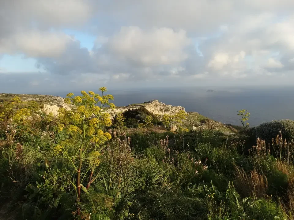
Further steep rock formations are encountered shortly after, near the Dingli Cliffs. We are amazed by such impressive beauty, and we are stunned to see rusted car carcasses at the bottom of the ravine. We don't understand if this is a place where people go to end their lives, or if there are other reasons. It's springtime, and the flowers with their tall stems offer ideal close-ups against the Mediterranean backdrop.

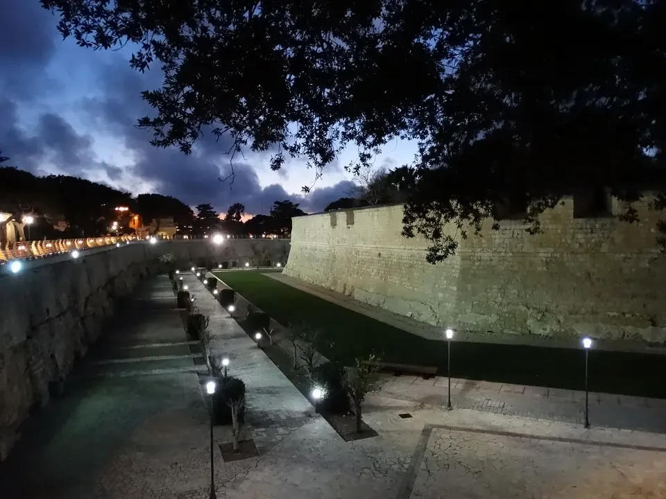
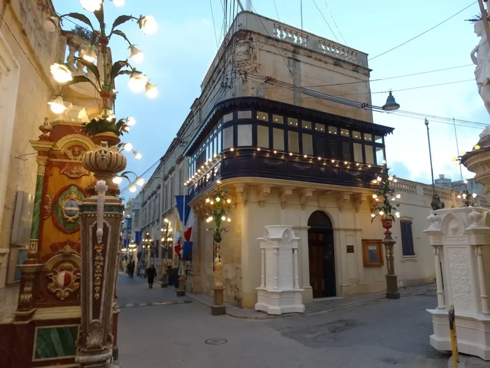
The shadows are getting longer and it's time to see the last two towns of Mdina and Rabat, which stand side by side and share a common history. The first one, in particular, owes its uniqueness to high fortifications that surround it. Inside, the citadel is dominated by the impressive St. Paul's Cathedral, the Catholic reference point of Malta. The yellow-toned public lighting makes us feel like we're in the Middle Ages, as well as the citizens The views from behind the walls appear as stretches of white, bordered by the fleeting green of this season. It is worth noting the lush lawn surrounding the fortress, so vibrant that it seems artificial. Rabat is simpler, were it not for the... lighting planned to celebrate the upcoming feast of Saint Joseph, the patron saint.


We decide to have dinner in the nearby town of Mosta, where the round church It's not far from the Pantheon. At a restaurant in the city center, we try a selection of local specialties, including rabbit. We didn't get tired (though that's a bit of an exaggeration).

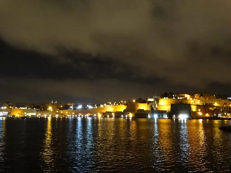
Let's go back to Vittoriosa to visit the Capital at night on the other side of the bay. Everything is well lit, and the monuments reflected in the water create the feeling of being doubled. We also think that we have seen enough for today and return to Mellieha for a well-deserved rest.